Plant and your spouse plants with you; weed and you weed alone.
Jean-Jacques Rousseau
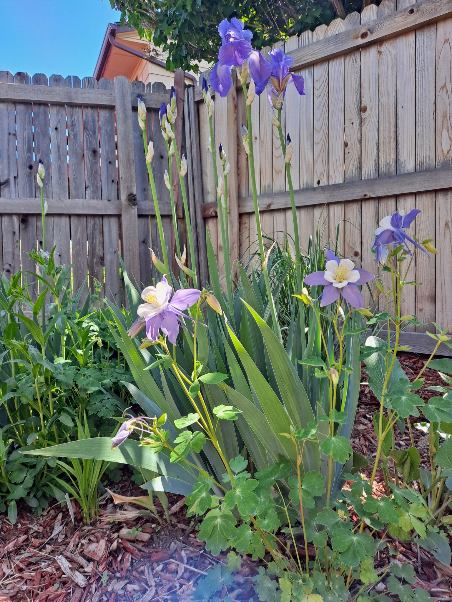
Rhapsody in blue: this duet of blue bearded iris and blue columbines harmonize in the backyard.
The first day of summer is tomorrow, but here in the Vintage garden the summer heat is already making it’s presence felt.
While much of the American West saw less than average rainfall in April and May, the Colorado Front Range looked and felt more like the Pacific Northwest with all the rain and cooler weather that we’ve received.
Well, all that cool weather and moisture came to abrupt stop as soon as the Memorial Day weekend ended. It was like ol’ Mother Nature flipped a switch; I went from having to wear a heavy jacket and gloves on Memorial Day to wearing shorts and flip-flops two days later.
Now the temps are reaching the 90’s almost every day, and we’ve hit 100 degrees a couple days already. And it’s not even summer yet! Sheesh.
In spite of the weird spring, most of the garden is looking pretty good. Let’s take a tour.
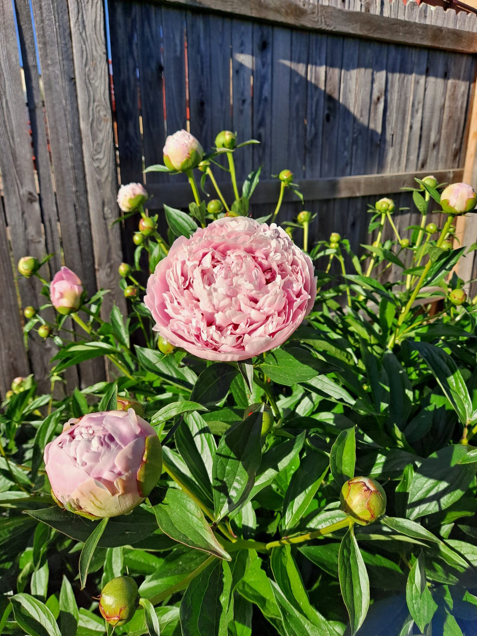
MrsVintage’s peonies are bursting into bloom.Jupiter’s Beard bring a pop of red color in the backyard long border.
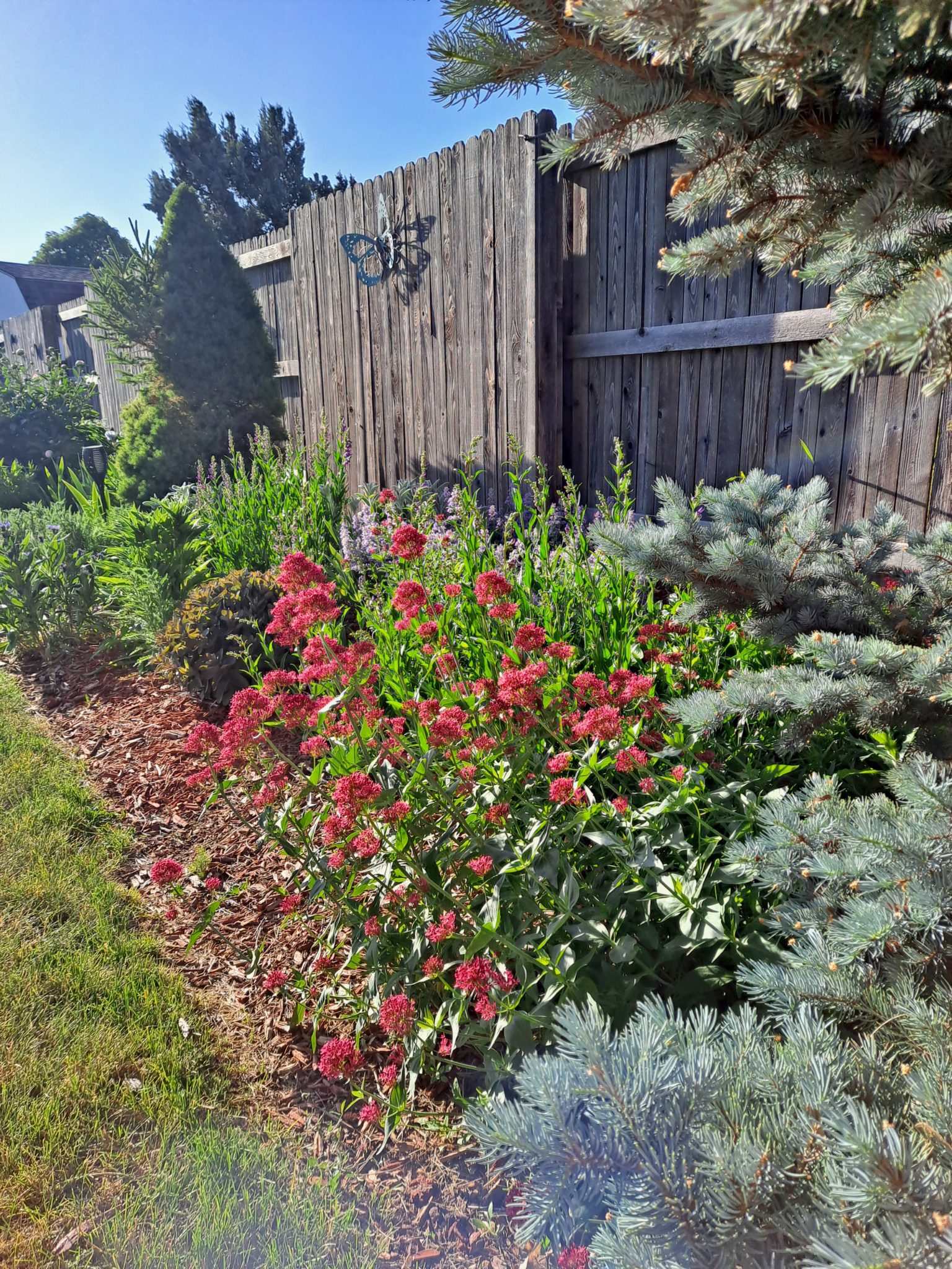
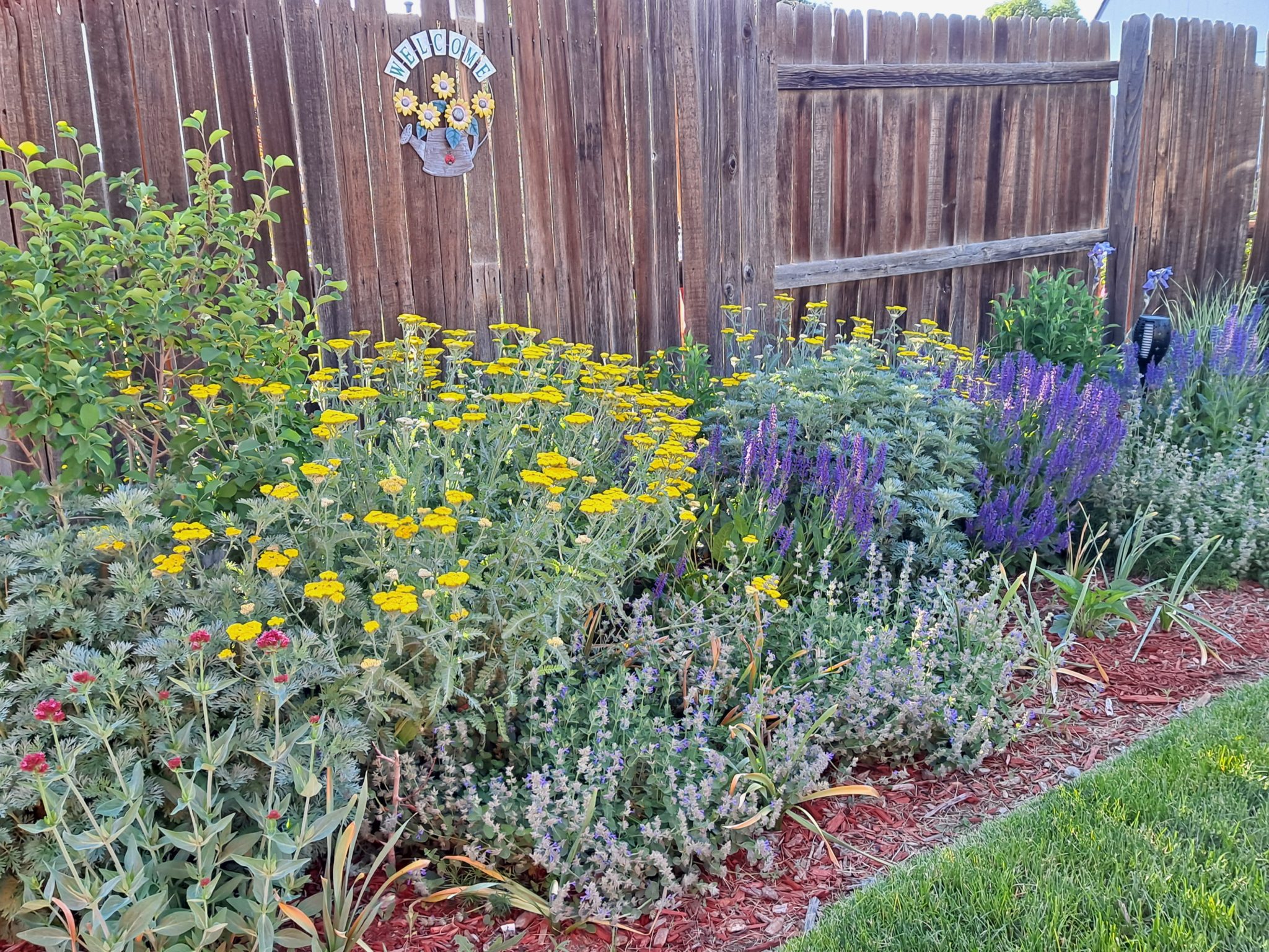
In the photo below you can see that the late spring/early summer border in the backyard is in full swing right now. I planted this border three years ago, and it is finally reaching its full potential. Overall, I am pleased with this border, but only middling so. I planted several Jupiter’s Beards to provide some red color to complement all the blue and yellow. Unfortunately, it looks like they didn’t make it through the winter.
When the local nurseries put their plants go on sale later this summer, I’ll pick up a few Jupiter’s Beards to round out this vignette. Of course, I’ll have to wait until the temperatures drop in the fall before I plant them.
What used to be the vegetable bed is now the late spring/early summer border. Looking pretty good if I do say so, but I feel it needs a little more red. What you see here is ‘Coronation Gold’ yarrow, ‘May Night’ salvia, ‘Walkers Low’ blue catmint and the only surviving red Jupiter’s Beard. In the far right you can see a couple of blue irires.
Looking through all the photos I took for this post, I’ve become aware at just how much blue/purple dominates my garden in late spring and early summer. Which is cool, because I like the color blue. But as summer progresses, yellow and orange will come to rule the yarden and will continue to reign until autumn arrives. Then purple/blue will return to share the throne with reds.
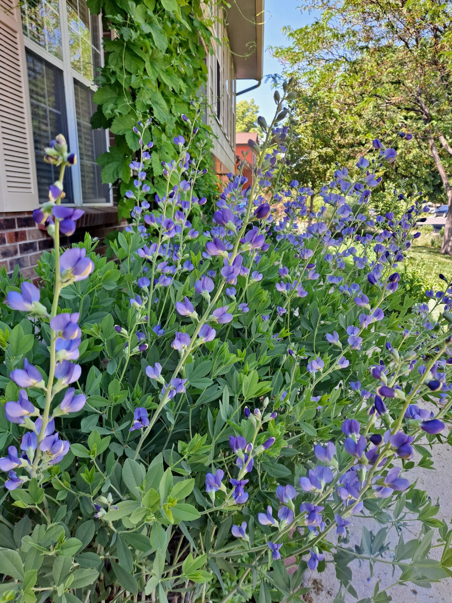
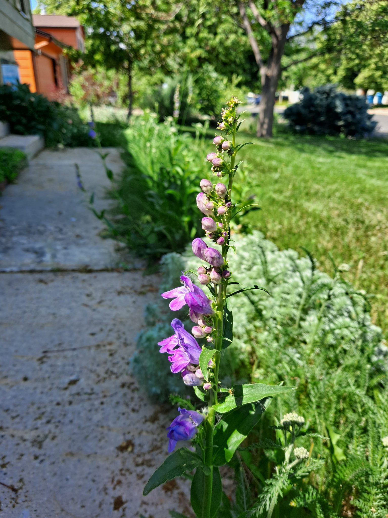
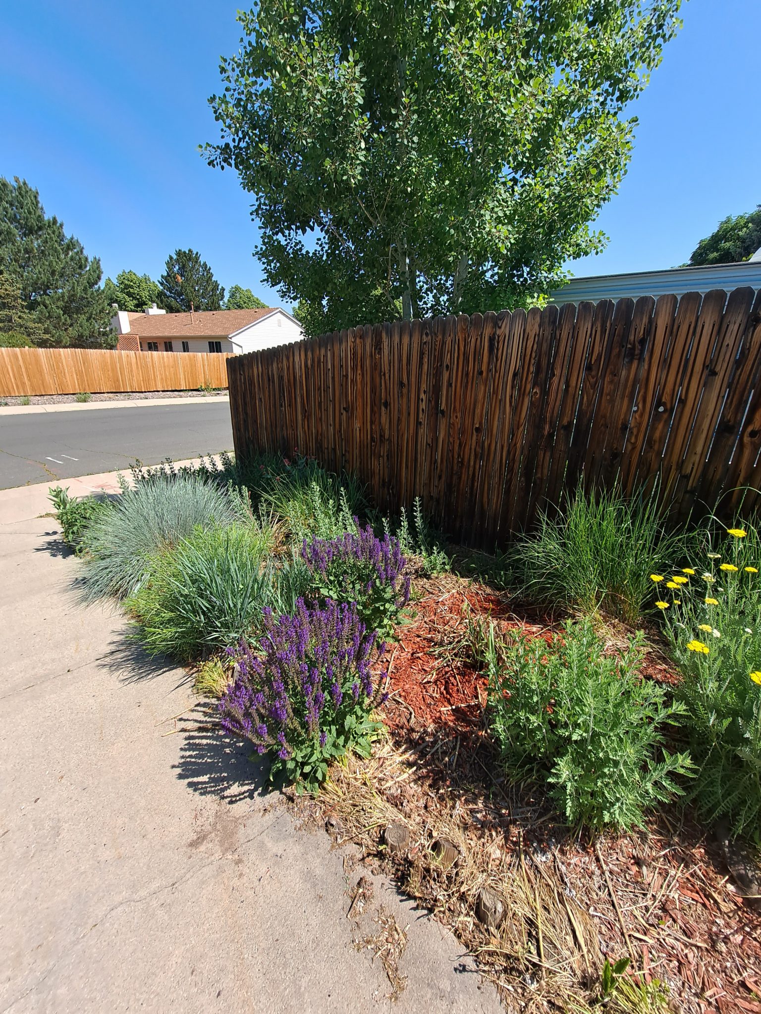
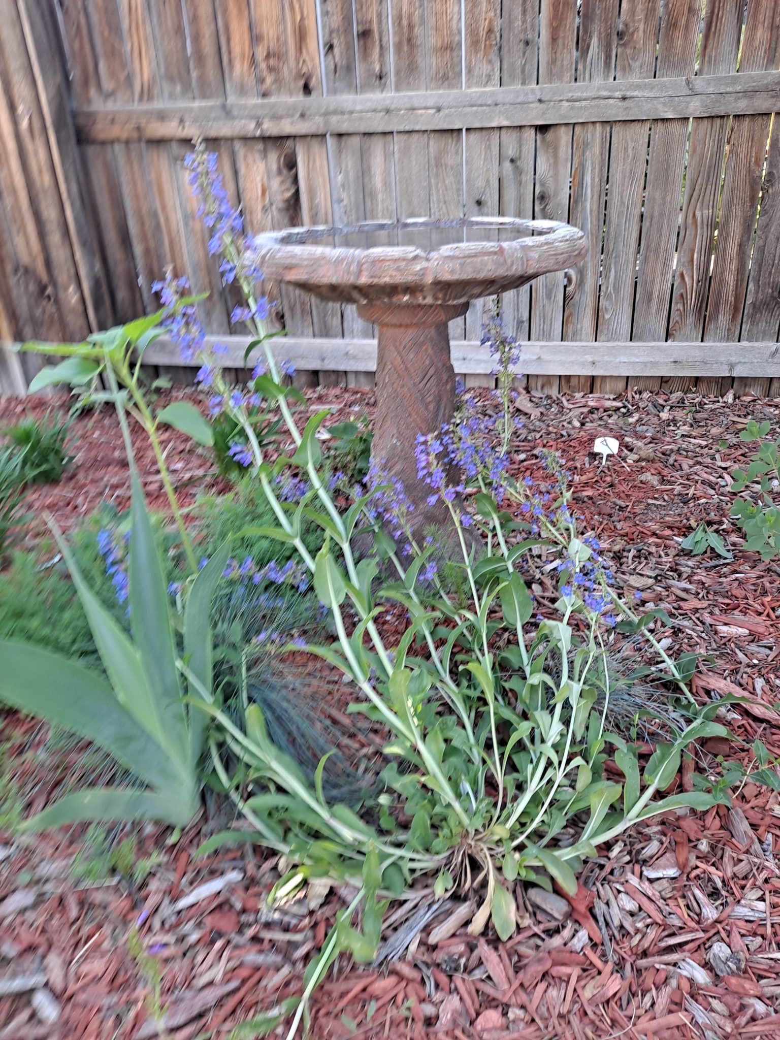
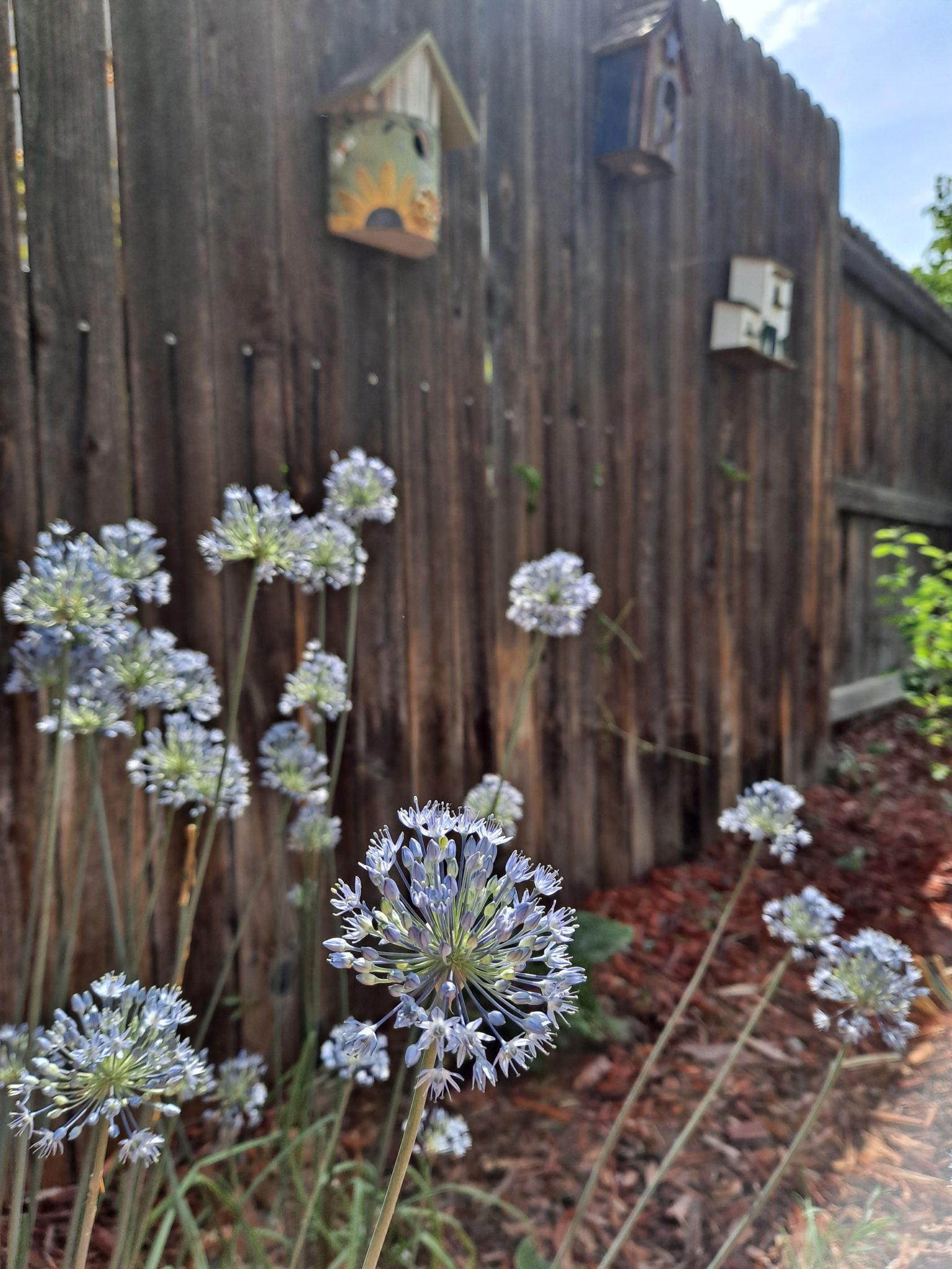
Baptisia, also known as false indigo, creates a pool of blue in front of the house.A blue penstemon, variety unknown, along the front walk. I didn’t plant this penstemon, it made itself at home here.Deep blue “May Night” salvia and blue oat grass hold court in the driveway border.Another blue beauty, “Grand Mesa” penstemon, which is a Colorado native, blooms in the birdbath garden. You’ll note that that the flowers are flopping toward the birdbath. I suspect all the rain the Vintage garden received over the past two months led to too much growth. After it finishes flowering, I’ll cut this penstemon back so it’s not leaning like a drunken frat boy. Sorry that the photo is out of focus.Blue alliums are closing out spring and welcoming in summer.
It’s not just my plants that have been exploding into bloom. The weeds, especially bindweed and thistle, have been on a rampage this spring. I suspect that all that moisture we received in April and May caused them to run riot throughout the garden. While I try to go out everyday to pull weeds, I am not ashamed to admit that in some cases I have also employed chemical weed control methods.
As the heat of summer carries on, the weeds will slow their roll. I just need to stay on top of them in the meantime.
“Travel makes one modest. You see what a tiny place you occupy in the world.”
Gustav Flaubert
In part 1 of my post on the VintageFamily’s 2005 Great Southwest Desert Roadtrip *insert blog link*, I highlighted our visits to Great Sand Dunes and Mesa Verde national parks. I ended the post with our visit to the Four Corners area. In today’s post I pick up from when we left Four Corners and continued on with our journey to the Grand Canyon.
We left the Four Corners area after lunch, which would turn out to be a big mistake, as the drive to the North Rim of the Grand Canyon was a lot longer than I thought it would be.
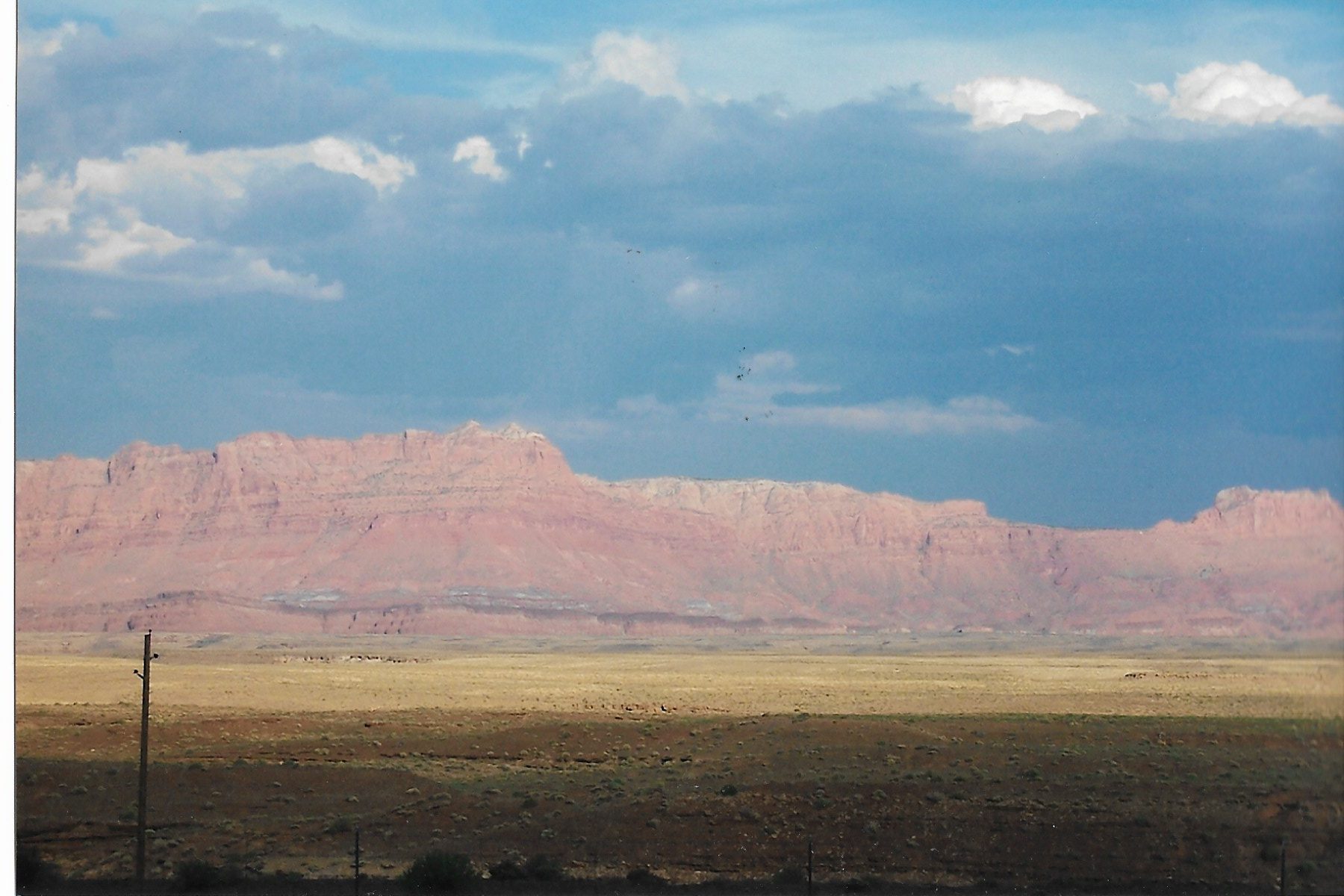
We quickly crossed over into Arizona, and we immediately began traveling through some strange and lonesome lands. At Tuba City, we turned north and headed to Lee’s Ferry. We practically had the road to ourselves the whole way. I would say I saw less than a dozen cars until we reached Lee’s Ferry. Our only companions were the Echo and Vermillion cliffs that run parallel to the highway.
It was kind of unnerving, to be honest.
The Vermillion Cliffs in northern Arizona.
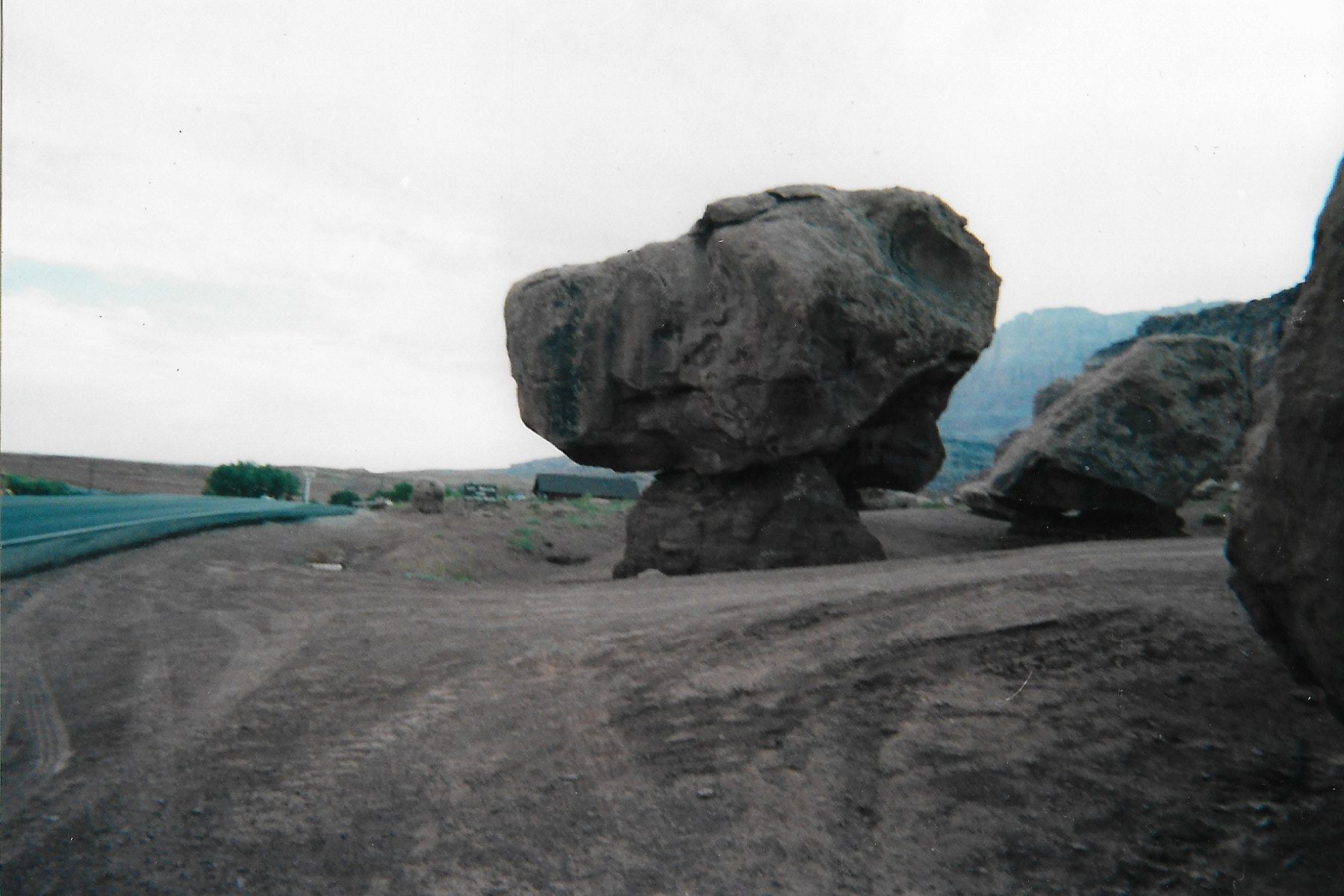
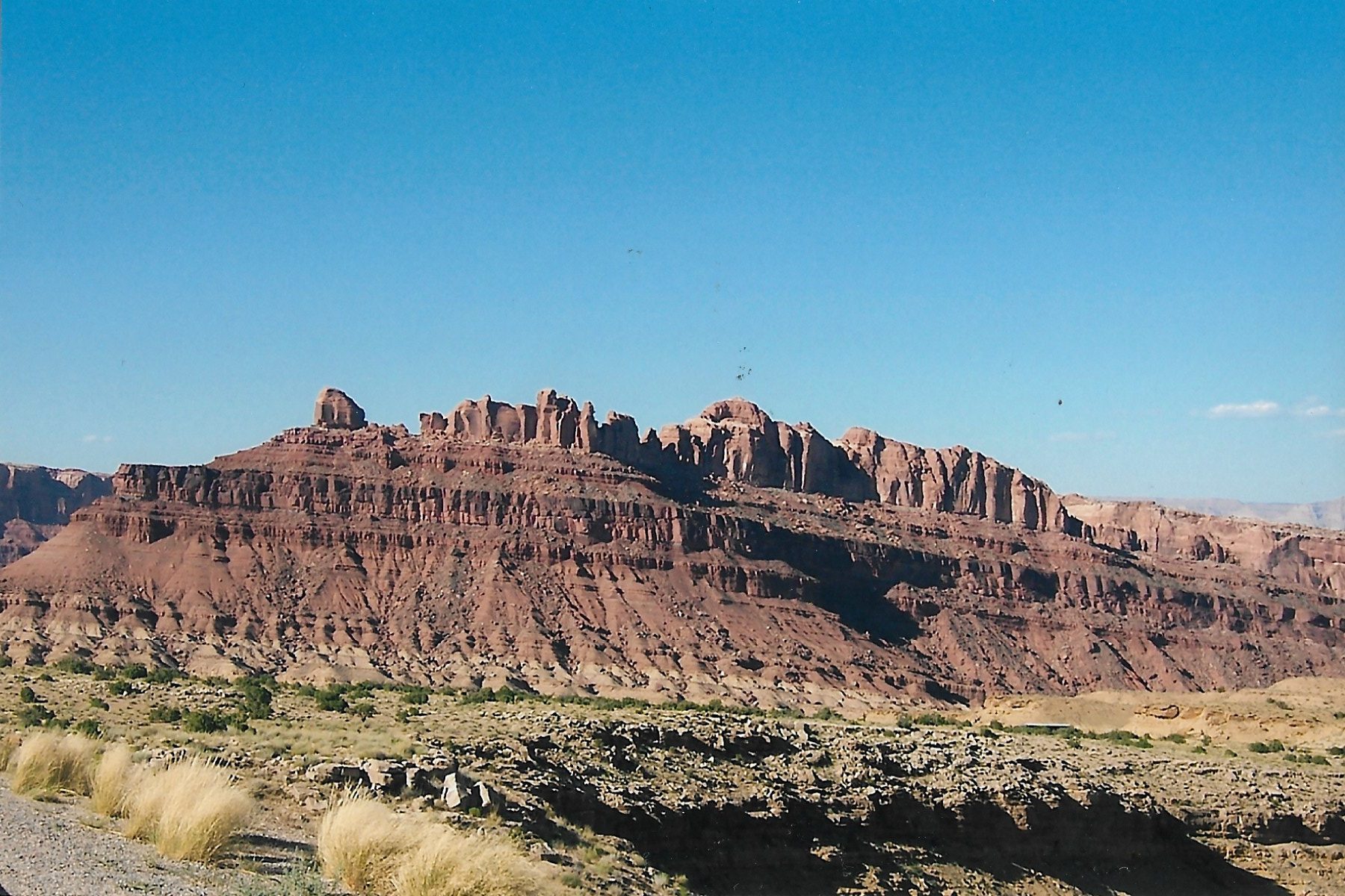
Once we got close to Lee’s Ferry, we stopped to stretch our legs and get some drinks and snacks out of the coolers. We also took the opportunity to snap a few pics of some really weird rock formations.
Strange rock formations at Lee’s Ferry in northern Arizona
Having worked the kinks out of our legs and backs, we climbed back into the van and made the final push to the Grand Canyon. It was getting dark and we needed a place to rest our weary heads.
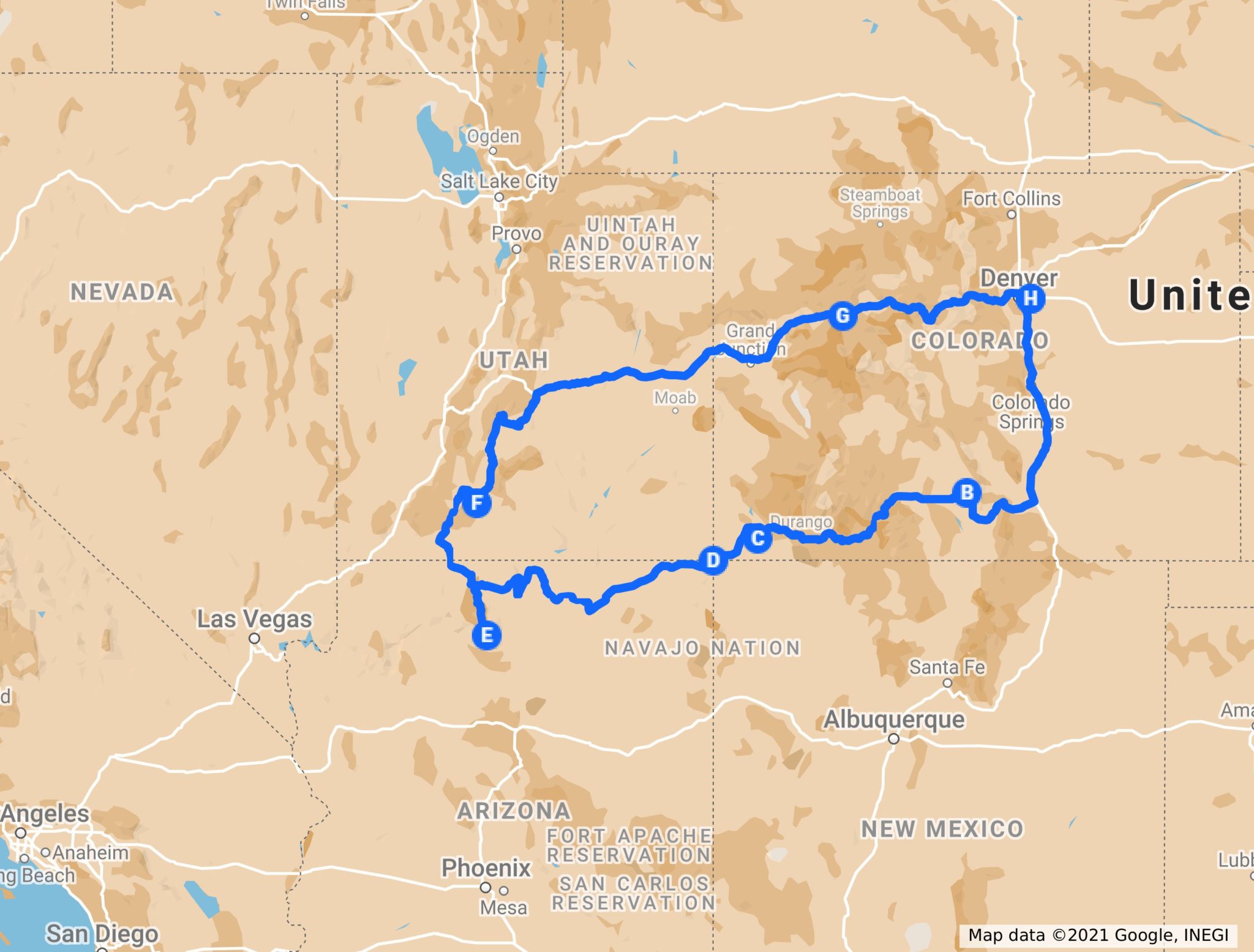
E – The Grand Canyon
Unfortunately, my gambling ways on not making camping reservations finally bit me in the ass. The campground on the North Rim was full, and was pretty much full for the foreseeable future. (In my defense, the reason I hadn’t made reservations was because I didn’t want to be locked into a hard schedule. If we wanted to stay longer at a certain area, or if we wanted to see something else along the way, I wanted to have the flexibility to do so).
With camping out, we began searching for a place to sleep. Remember, this was before smart phones, so we had to find lodging the old fashioned way: we drove around until we found a motel with vacancies. We finally found a place in Kanab, Utah, where we would spend the next few nights.
Kanab is about eighty minute drive to the Canyon, and I found the drive to the canyon fascinating. In a drive of less than 70 miles you end up traveling through dramatic changes in the landscape, as you can see below.
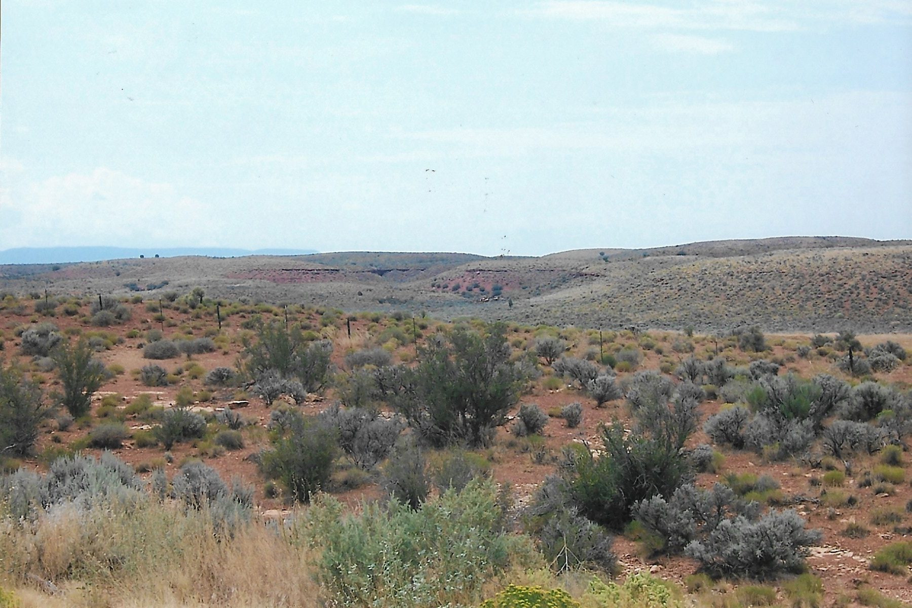
When you leave Kanab, you start by driving through desert scrub brush…
Leaving Kanab and heading south through desert scrubland
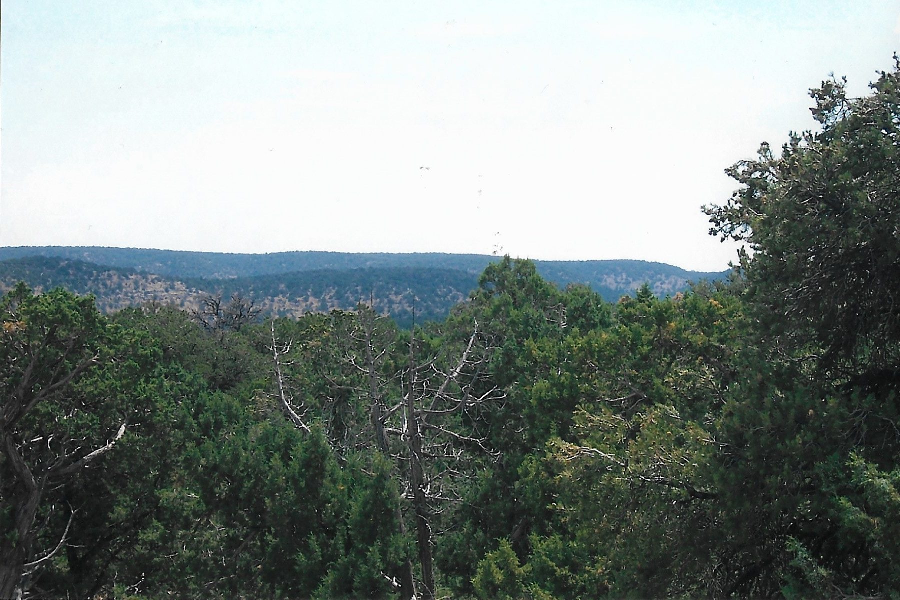
While halfway through the drive, you find yourself traveling through juniper/pinyon pine forests…
Pinon-Juniper forests on the drive to the Canyon
Until you reach the North Rim of the canyon, where you will find yourself surrounded by Ponderosa pines and Spruce trees. All that changes in little over an hour of traveling time. It almost felt like we were back in Colorado. The North Rim sits at 8,000 feet of elevation, and so it has a very similar climate to the mountain forests of Colorado.
As a matter of fact, the North Rim is over one thousand feet higher than the South Rim, and thus it is the more temperate of the two rims.
Spruce and Ponderosa on the North Rim
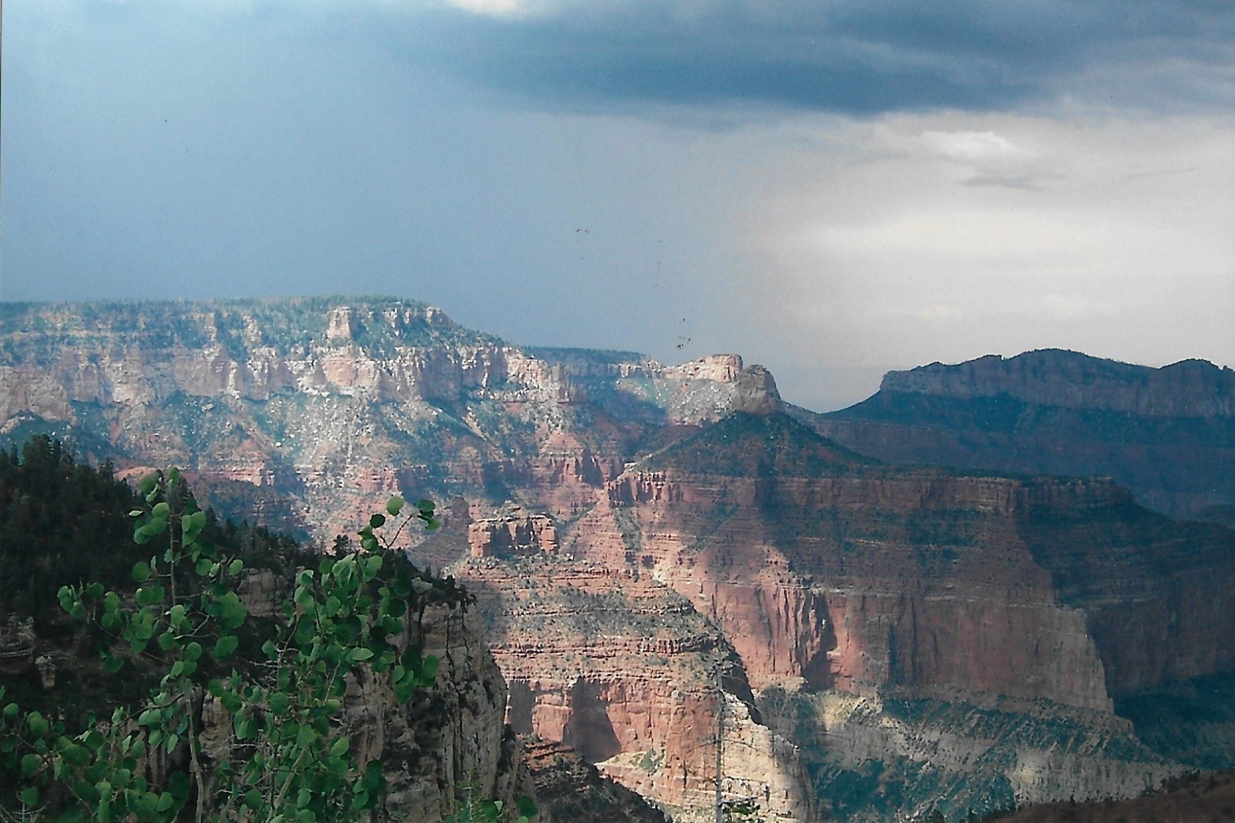
The Canyon
What hope is there in using words to convey the awesome majesty of the Grand Canyon? What superlatives haven’t already been exhausted in trying to describe just how overwhelming the experience of the Canyon is? This is one of those places that if you have been there you know, and if you haven’t, then you need to see it for yourself.
The truth is, trying to comprehend the Canyon has a way of bending the human mind.
Let me provide you a couple of examples of that. The first Spanish explorers to visit the canyon were actually unimpressed by the Canyon. To them this was just another ravine, among the countless other ravines scattered throughout the West, that they needed to find a way to traverse. They saw the mighty Colorado river as nothing more than a tiny stream at the bottom of a gully. It wasn’t until they sent scouts partway down into the Canyon that they started to get a glimmer of what they were witnessing. What they thought were just some rocks turned out to be boulders bigger than houses. They ultimately decided to skirt the canyon, but in the accounts of their travels they make almost no mention of this immense canyon! Their minds refused to accept the enormity of what they had encountered.
Here’s another: one one of her shows, TV travel host Samantha Brown took a helicopter tour of the Canyon. The pilot of the copter approached the rim of the Canyon at low altitude, practically nap of the earth, so as not to spoil the surprise. Ms. Brown is one of those perky and relentless upbeat type of people, and she was chattering away excitedly (nervously?) to the pilot non-stop on the approach to the Canyon. Then, when the helicopter flew past the rim and the Canyon dropped beneath them in all its majasty, Ms. Brown was actually rendered speechless. She even wept.
Such is the power of the Canyon.
Alright, since words are useless in trying to convey the pure awesomeness of the Canyon, I’ll focus instead on our visit. We chose the North Rim for a couple of reasons, the biggest of which is that this side of the Canyon only receives a tenth of the visitors the South Rim does. Fewer visitors = fewer crowds.
Second, as I mentioned above, the North Rim is more temperate than the South Rim. Daytime temps can be 8-10 degrees cooler on the North Rim than the South Rim. Seeing as we visited in the middle of July, cooler temps made for a better experience.
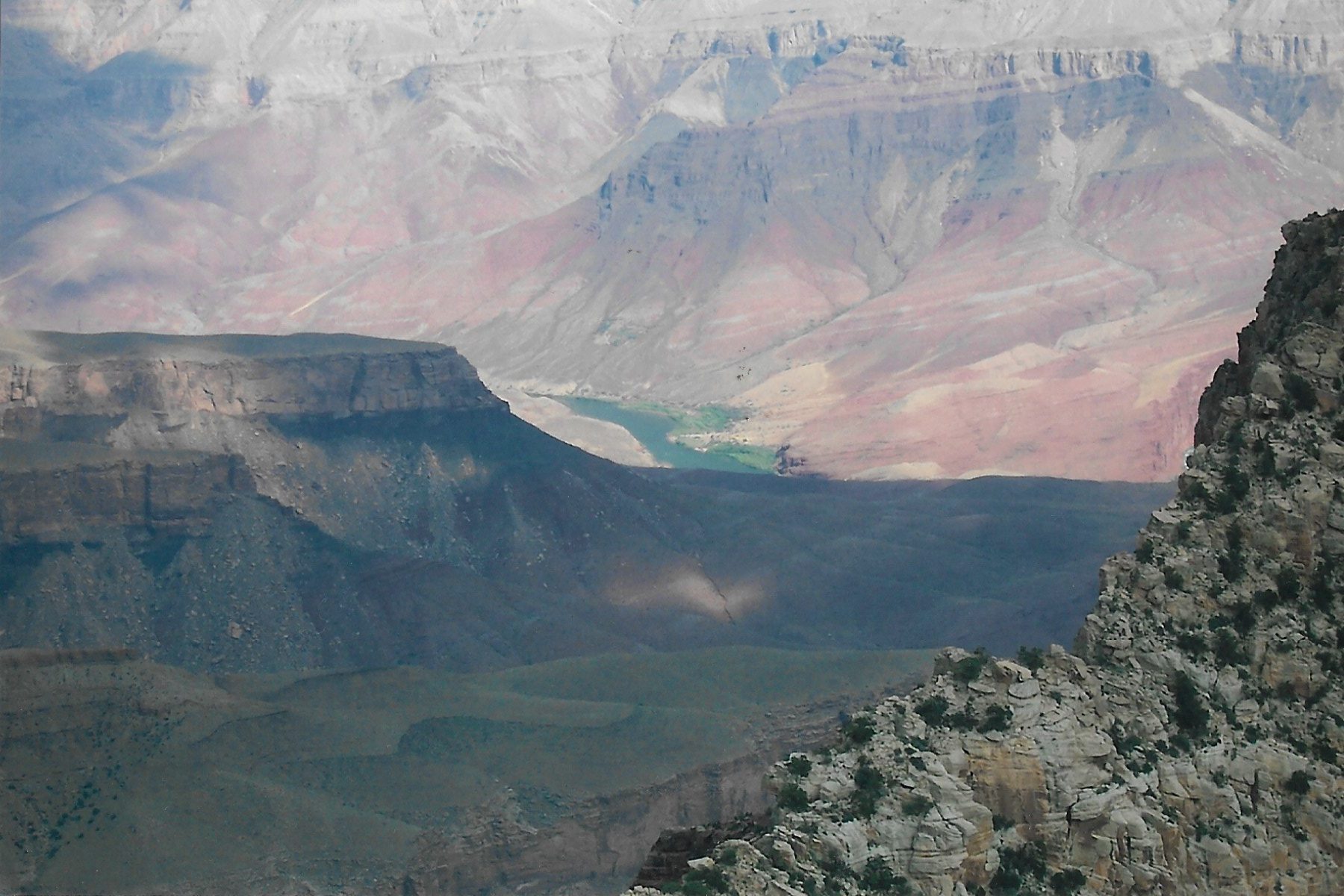
Along the North Rim, there is only one spot where you can see the mighty Colorado river
I highly recommend checking out different views of the Canyon by taking the North Rim drive. This 23 mile road takes you from the Lodge to Cape Royal, and there are numerous stops along the way where you can get out and take a short hike or just snap some pics.
If you choose not to camp, the North Rim Lodge is available, but I have no idea how nice the rooms are. I’m going to assume that they are awesome, because the Lodge itself is beautiful. The Lodge also has a restaurant/dining room, as well as a well stocked deli. We ate lunch at the deli a couple of times, and while the prices of the food were outrageous, the food itself was fine.
If you choose not to stay in the park, your options are kind of limited. The towns of Freedonia, AZ and Kanab, UT are about an hour and half drive away. While both towns have motels, Freedonia’s had more of a “truck stop” vibe to it.
After spending a few days at the Grand Canyon, it was time for the VintageFamily to travel to another world.
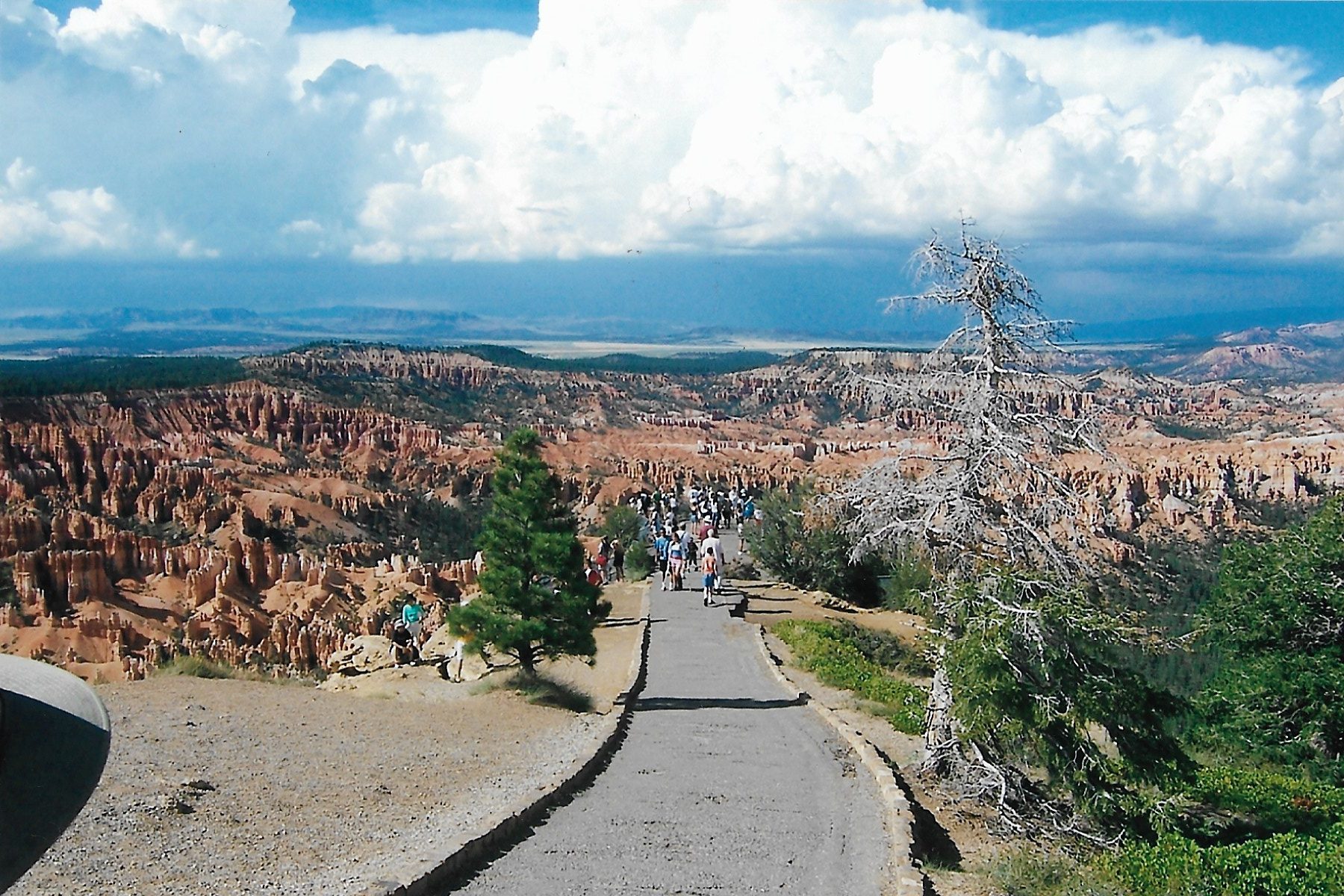
F – Bryce Canyon, land of the Hoodoos
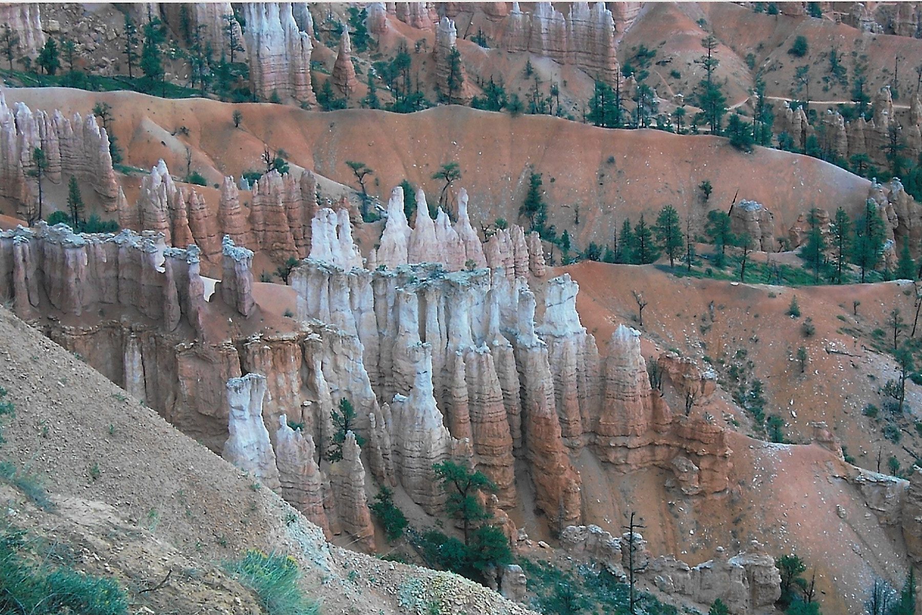
There are places in Utah that look like they come out of a Salvador Dali painting. Bryce Canyon is one of those places. Weird rock formations, called “hoodoos”, have been carved out of sandstone by ice, water and wind. The most impressive location to view these hoodoos is in the Bryce Amphitheater.
Hoodoos, castles and spires await in the Bryce Canyon Amphitheater.
The Bryce Amphitheater is a bowl shaped depression on the eastern slope of a plateau. The shape of this bowl depression created the conditions that formed these weird rock formations.
Hiking is permitted in the Amphitheater, as long at you don’t climb on or mess around with the hoodoos. In spite of the fact they are made of stone, they are quite fragile.
If you don’t feel like hiking, but want to see more of the park, there is a 18 mile rim drive that starts at the Visitor Center and ends at Inspiration Point. There are 13 stops along the way to get out and enjoy the views.
Apparently, there is now a shared-use paved path available as well. This path can be used by pedestrians, bicyclist, skateboarders and more. You can even rent a bike if you didn’t bring your own (Mountain Bike Tours & Rentals | Bryce Canyon Country).
Stone “castles”
I think the whole family agreed that we found Bryce Canyon to be a little bit more of an enjoyable experience than the Grand Canyon. The Grand Canyon was just so big that our brains had a hard time wrapping around it. The smaller scale of Bryce Canyon, while strange, still made for a rather intimate adventure.
Bryce Canyon is fairly remote. The nearest decent size town is Glendale, and it’s about an hour away. There is a general store in the park that sells grab-and-go foods. The Bryce Canyon Lodge has motel style rooms and cabins, as well as a dining room. Again, I have no idea of the quality.
After weeks on the road, the VintageFamily was getting weary and homesick. It was time to return to Colorado, but not before making one last stop.
G – Glenwood Springs and Hanging Lake
A funny thing happens on trip when you’ve decided it’s time to go home; now all you want to do IS go home. No more side trips or checking out scenic views. It’s pedal to the metal.
But after spending over two weeks traveling around the dry and dusty Southwest, we felt that we owed it to ourselves to spend a little time in more hospitable climes.
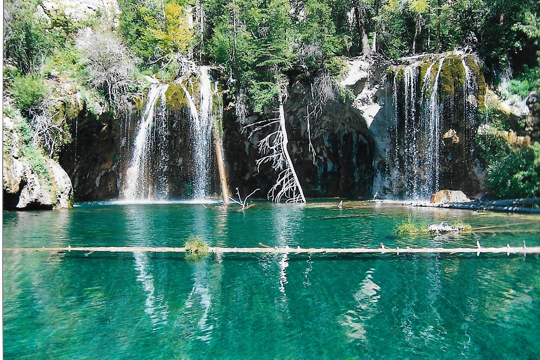
On the last day of our roadtrip, we decided to hike up to Hanging Lake, just outside of Glenwood Springs. While MrsVintage chillaxed in the van, the VintageDaughters and I made the one mile trek up to the beautiful lake. While the trail is short, it is relatively steep, so be prepared for a good workout.
Waterfalls at Hanging Lake, just 10 miles east of Glenwood Springs
After the VintageDaughters and I returned to the van, we grabbed some cold beverages and lunch. Then we packed everything away and drove the final leg for home. The Great Southwest Desert Roadtrip was done.
Epilogue:
The Great Southwest Desert Roadtrip was a fine adventure for the VintageFamily, possibly one of the most memorial trips we ever made.
We got to see mountains, sand dunes, ruins of a long-gone civilization, tourist traps, a mind-boggling Canyon, alien rock formations, a lake perched on the side of a mountain and lots of different kinds of animals.
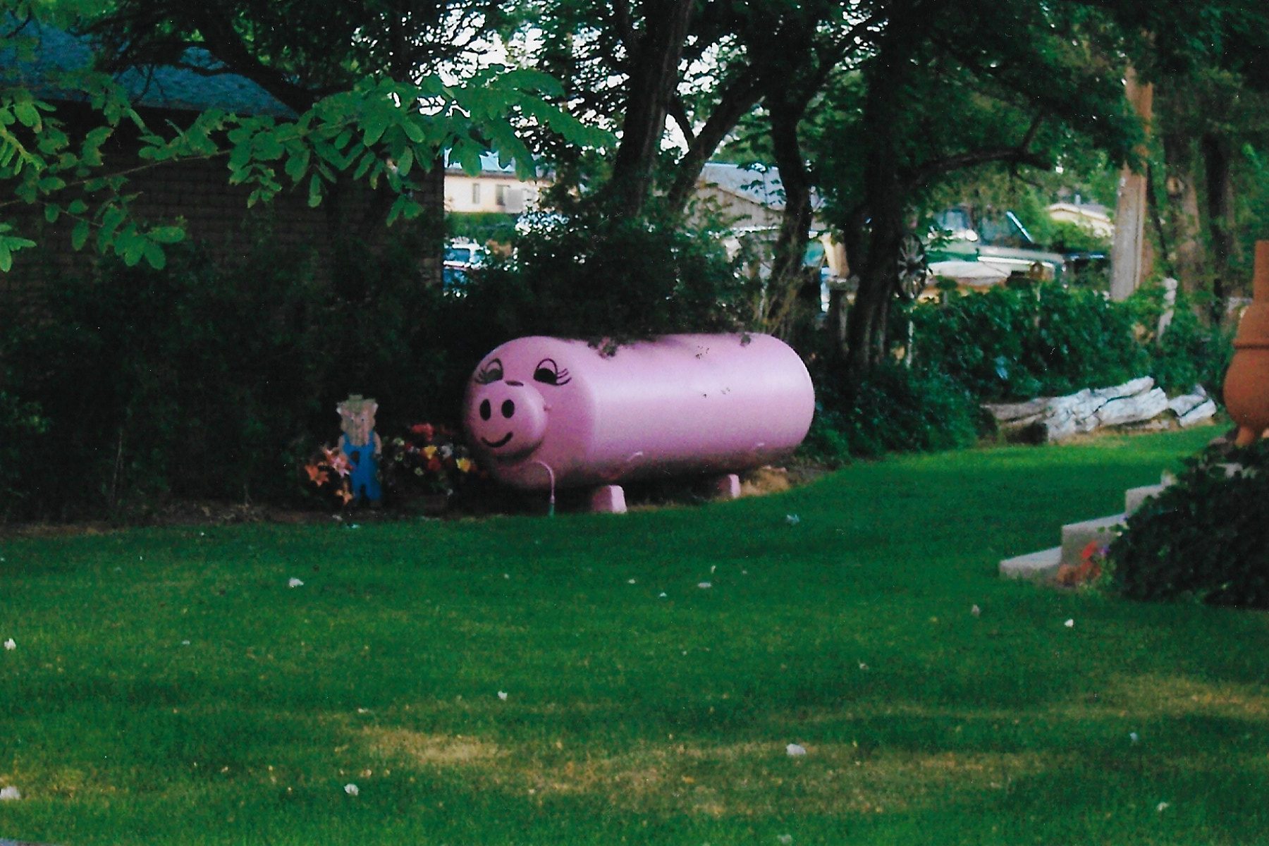
We even saw a septic tank dressed up as a pig!
Some pig!
So while much has changed in the American Southwest over the intervening years since my family and I made this trip (especially prices!), the places we visited are timeless and immutable. There is so much to see and do in that part of the country, and I hope this post has inspired you to visit fascinating region.
Happy Trails my friends!
Posted inAmerican West, Travel|Comments Off on The Great Southwest Desert Roadtrip (Part 2):
Hopefully the worst of the Covid nightmare is behind us, and people will be able to get out and travel again this year. I thought I would offer a few recommendations from some of my favorite travel experiences over the years. I can’t say the Vintage family went off the beaten track when we traveled, but I can make a few suggestions that helped make our trips more a little more memorable.
Today’s post: Part 1 of the Vintage family’s Great Southwestern Desert Roadtrip.
“It’s a dangerous business, Frodo, going out your door. You step onto the road, and if you don’t keep your feet, there’s no knowing where you might be swept off to.”
J.R.R. Tolkien
The Grand Circle
Back in 2005, the Vintage family went on a multi-week roadtrip to explore some of the natural wonders of the American Southwest. Our itinerary took us through states of Colorado, Arizona and Utah, and included visits to several National Parks.
While a lot has changed in the human world over the intervening 15 years, the beauty of the American Southwest remains the same.
There is a region of the American Southwest that is sometimes referred to as “The Grand Circle”. This circle includes southwestern Colorado, northwestern New Mexico, large portions of Arizona and Utah, and a sliver of Nevada. Click on lthe link below to see a map of this circle.
Within this circle are some of the most beautiful and iconic areas of the American West. The Grand Canyon, the lakes Powell and Mead, the San Juan mountain range, reservations of the Navajo and Zuni, the towns of Santa Fe and Telluride, and so much more. It’s a land where Native American, Hispanic and American cultures once clashed, and now live side-by-side.
One could spend a lifetime exploring this region and still not see or do it all.
As I said, a lot has probably changed over the past 15 years as far as human activity goes, so I am not going to include places we ate or motels we stayed at because I have no way of knowing how those places are run now, or if they are even still in business.
B – Great Sand Dunes National Park
So on a very warm July day, we left our home (H on the map above) in the Denver Metro area and began our adventure by heading south. Our first stop was the Great Sand Dunes National Park.
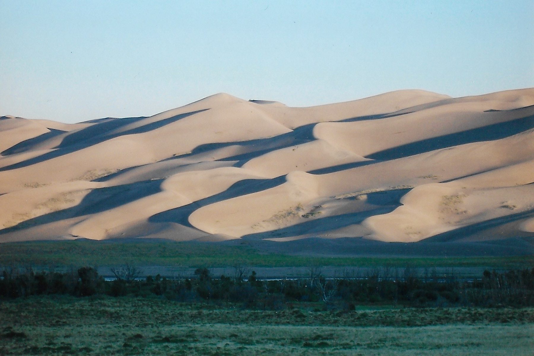
The San Luis Valley, located in southcentral Colorado, is as flat a place you’ll find outside of Kansas. Over the millennia, winds blowing over the valley have pushed sand and dust to the feet of the Sangre de Cristo, located in southern Colorado. Over time, these grains of sand have piled up to form the tallest sand dunes in North America. This dune field is known today as The Great Sand Dunes National Park.
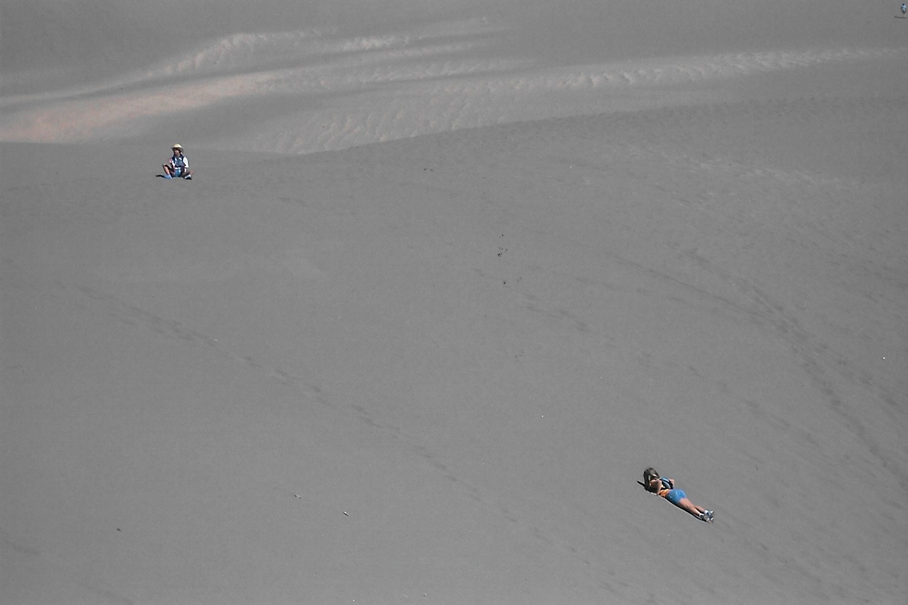
Morning light casting shadows on the dunes.
Obviously, these dunes are the showcase of the park. You can park near the foot of the dunes and walk right in and explore the dunes to your hearts content. A word of caution: I recommend starting early, because in summer those dunes get hot! Use lots of sunscreen, wear a hat and bring water. Lots and lots of water because you’ll need it.
When you’ve finished exploring the dunes, you can cool off by wallowing in Medano Creek, a tiny stream that flows at the foot of the dunes.
Vintage daughters trekking across a Saharan-like terrain.
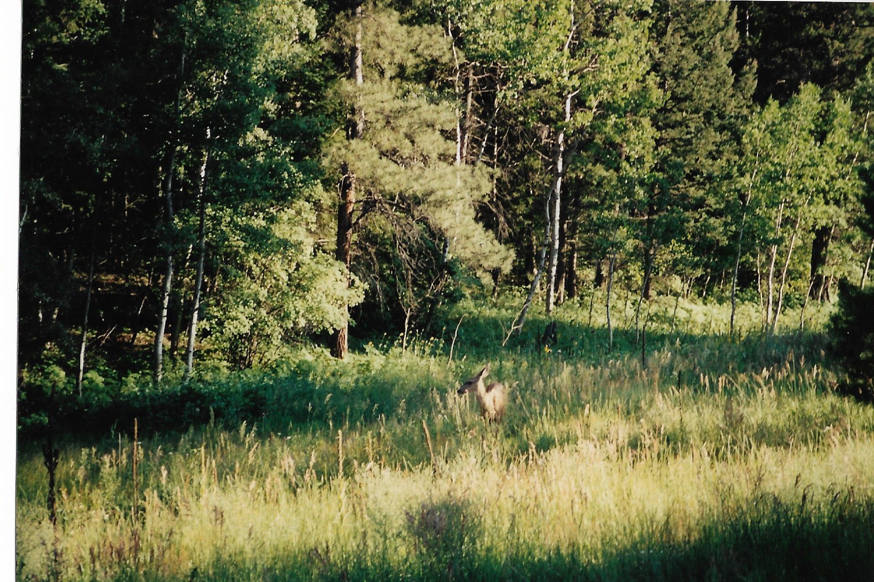
But there is more to the park than just the dunes. There are several hiking trails that wander off into the Sangre de Cristo mountains. We explored the Montville Nature trail, where we spotted the deer seen in the picture below. One of the longer trails will take you over Mosca Pass. There is even a trail that leads to alpine lakes called Sand Creek Lakes.
A deer on the nature trail.
Amenities: we camped in the Pinon Flat campground. Beautiful campground that is in easy walking distance to the creek and dunes. Potable water and flush toilets are available. NOTE: nowadays you need to make reservations if you are going to camp in the campground. You can reserve online 6 months out online at: Pinon Flats Campground, Great Sand Dunes National Park & Preserve – Recreation.gov
There are a couple of small motels outside of the park, but I cannot attest to their quality. As far as food goes, you need to pack it in with you. The town of Alamosa is about a 45 minute drive away, and does offer multiple places for lodging and eating.
After a few days at the dunes, we broke camp and then made our way deeper into the American Southwest. Out next stop: Mesa Verde National Park.
C – Mesa Verde National Park
I don’t know if this little factoid is still true today, but during our visit one of the park Rangers informed us that Mesa Verde receives far more tourists from overseas than it does from Americans, especially from Germany and Japan. Which is damn shame, because Mesa Verde National Park is a fascinating place.
Quick history lesson: the ruins at Mesa Verde were built over several centuries by a people called the “Ancestral Puebloans” (Anasazi is no longer the official name for these ancient people. Anasazi means “ancient enemy” in the Navajo language). Sometime around 1300 A.D. the Ancestral Puebloans abandoned their homes for reasons not entirely known. It is now believed that they moved and settled further east and the Pueblo Indians are their descendants.
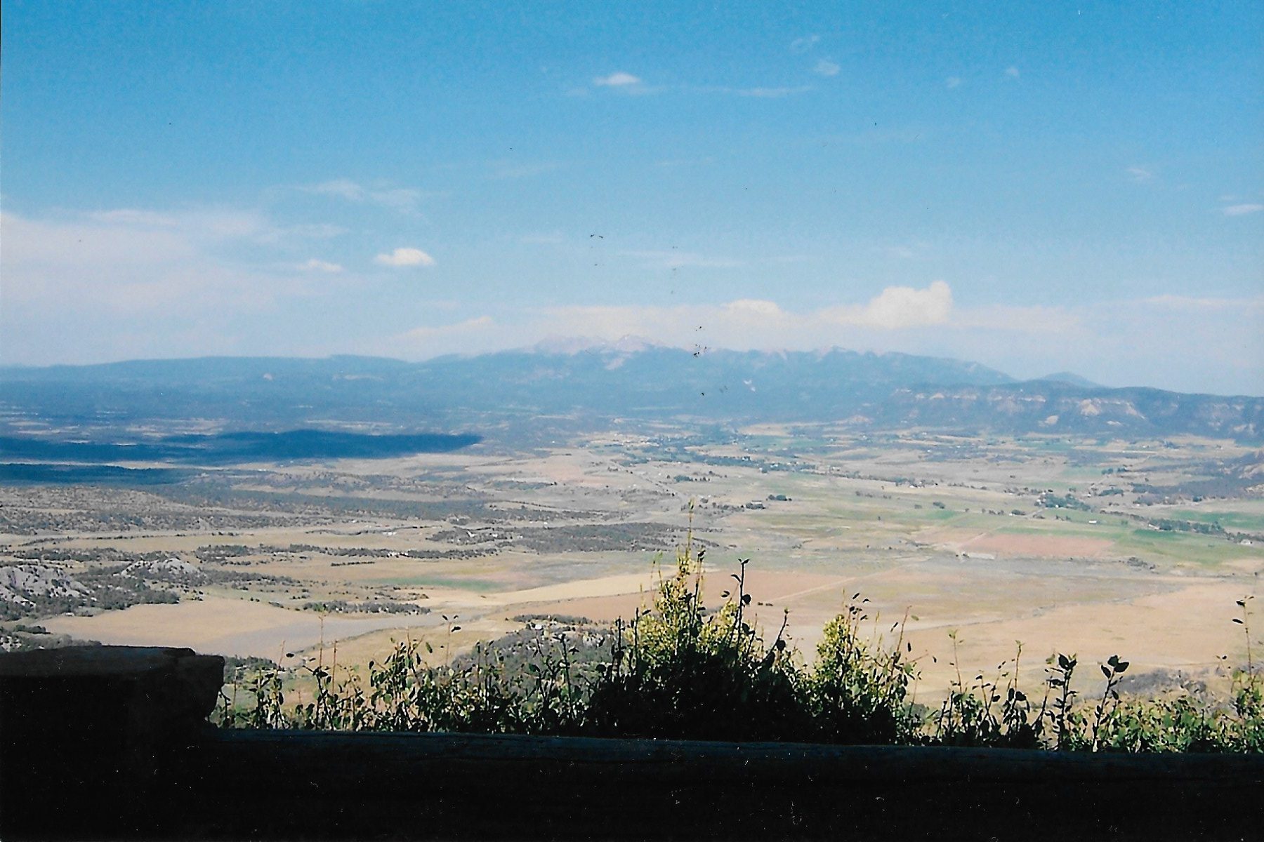
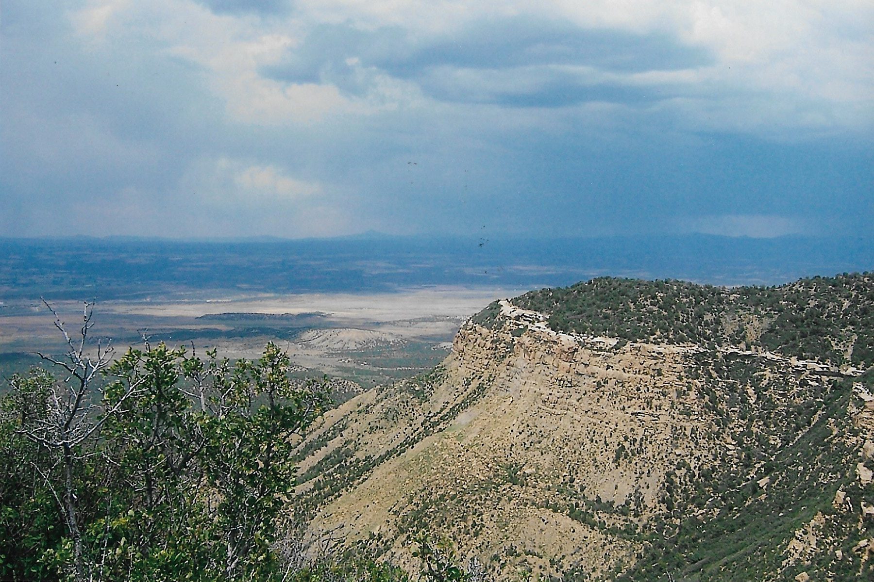
Mesa Verde is located in southwestern Colorado along Colorado Highway 160, near the Four Corners area. The entrance to the park is smack dab between the towns of Cortez and Mancos. The drive up to the park itself is breathtaking, as you can see in the photo below.
Sangre de Cristo mountains as seen from the road leading to the top of the Mesa. Quite a view, eh?
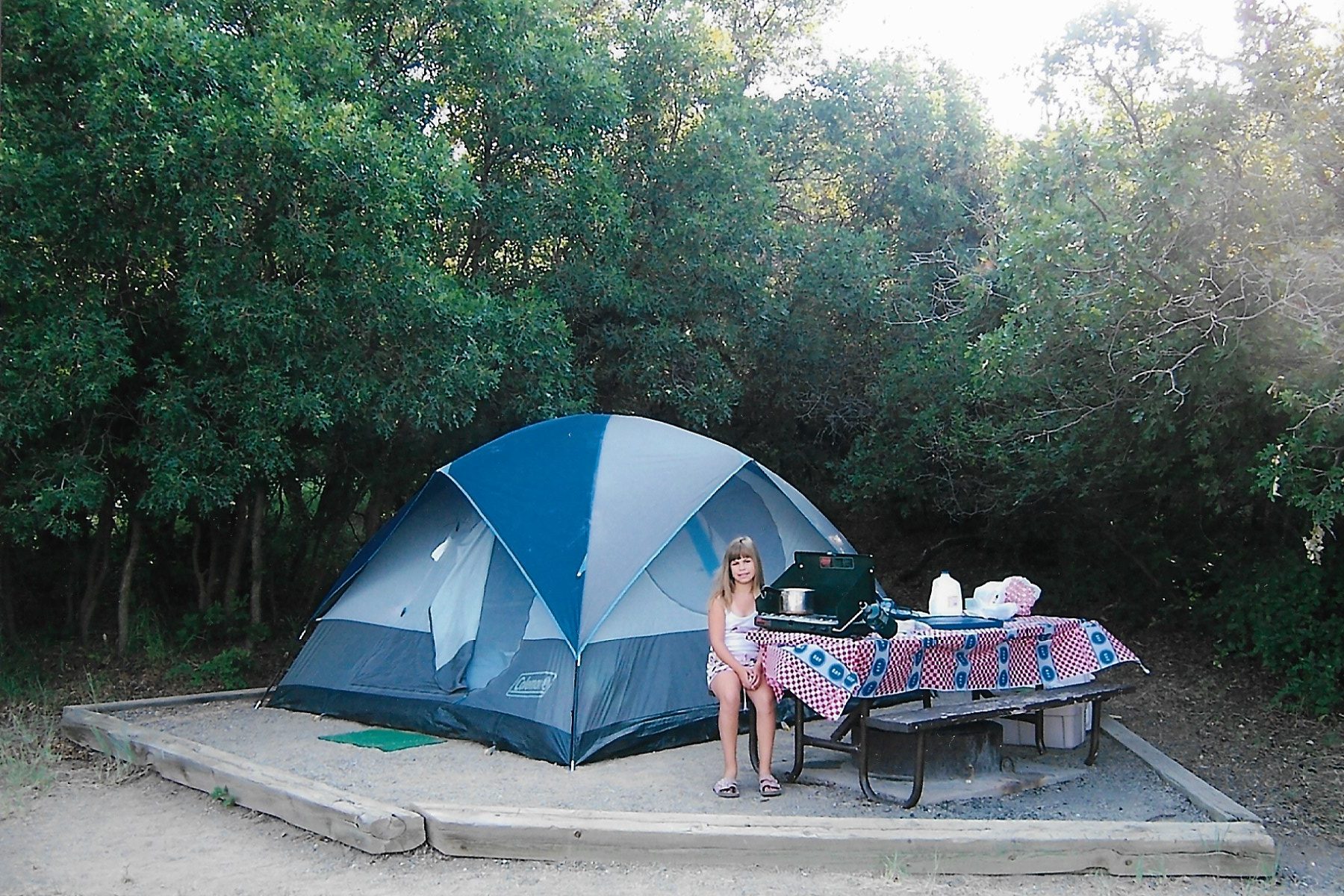
We camped in the park at Morefield campground. We were lucky enough to find a wonderful site shaded by Gambel oak. Morefield campground is the only campground on the mesa, but it has a lot of amenities: a store that provides ice and firewood, flushing toilets, potable water and laundry facilities. While we didn’t need to make reservations, nowadays a reservation is required.
One of the Vintage-daughters chilling by the tent in Morefield campground. All that shade cast by the oaks made camping here quite comfortable.
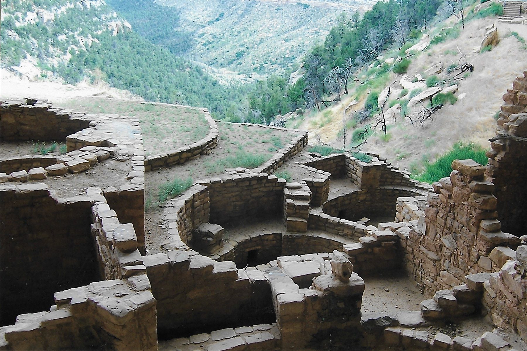
There is no way a blog post can ever do justice to all the things to see and do in Mesa Verde National Park. So, let me just show you a few high points of our visit there.
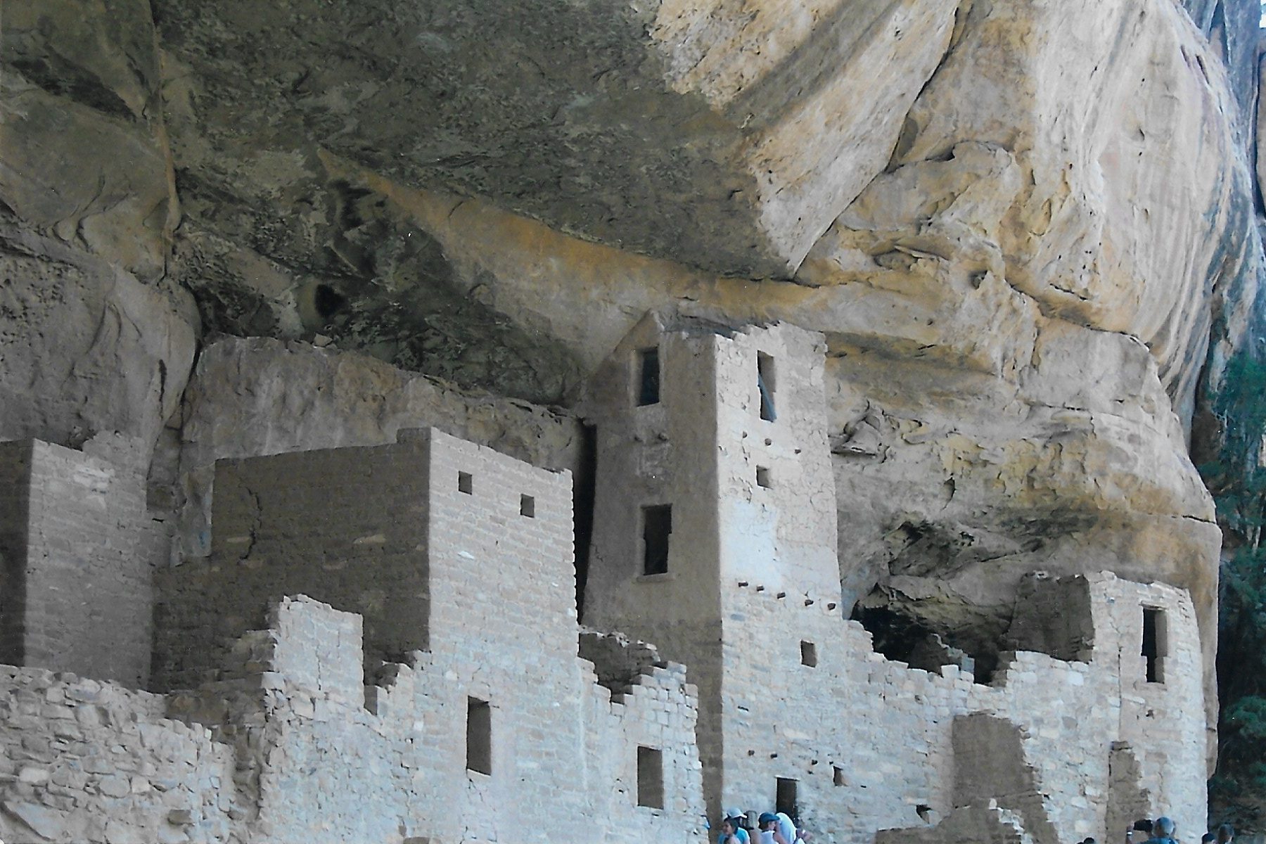
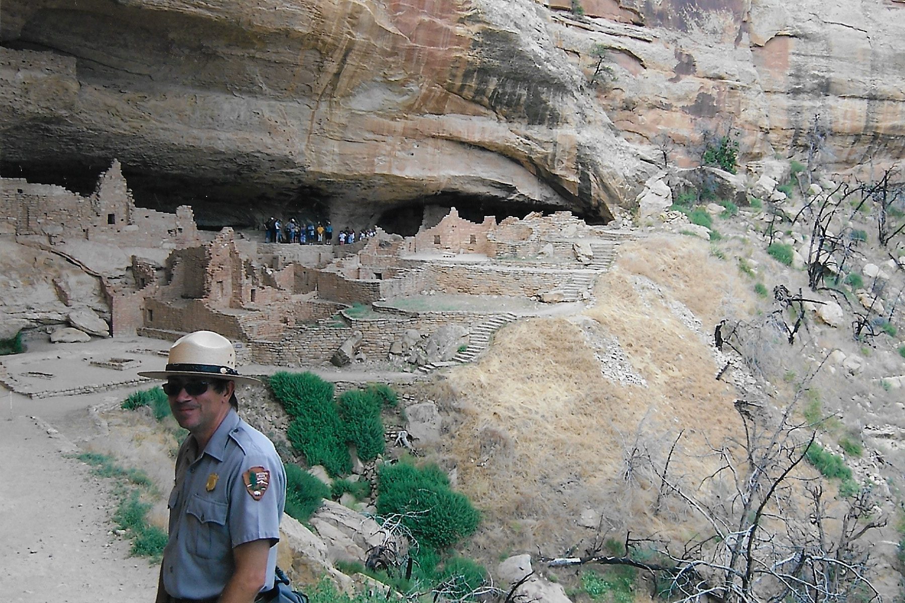
Cliff Palace and Spruce Tree house are two of the “must see” sites. Cliff Palace (seen below) is the largest ruin in the park.
Cliff Palace
The more popular ruins at Mesa Verde can become quite congested with fellow tourists, and wait times to see the sites is pretty much to be expected. To get away from the all the crowds, I suggest taking a drive along Wetherill Mesa Road…
Views from Wetherill Mesa Road
…until you reach the Long House ruins. Long House is Ranger guided-only, which means you can’t just show up and wander around. According to the National Park Service website (Mesa Verde National Park (U.S. National Park Service) (nps.gov) the tour costs $8. But it is well worth it, because you can get much closer to the ruins.
A Ranger guide is required to visit Long HouseExploring Long House
I also recommend making a stop at the Chapin Mesa Archeological Museum, where you can learn all about the people who built these ruins as well as other artifacts from the park. We found the museum to be quite informative.
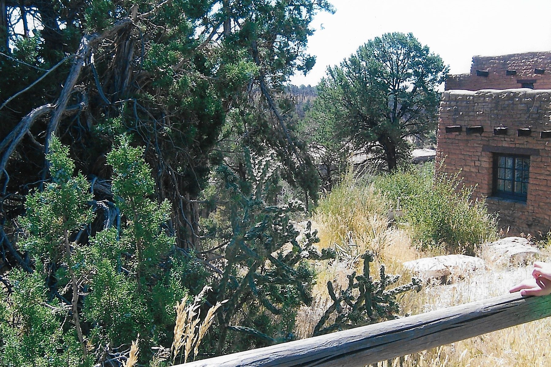
You can see part of the Chapin Mesa Archeological Museum on the right, but I was rather fascinated by the landscaping outside the museum. Especially the funky looking cactus, which I now know to be “Cholla” cactus.
If you don’t like camping, there is a motel in the park called Far View Lodge (reservations required). I have heard good things about it, but have never stayed there.
The towns of Mancos and Cortez are about an hour drive from the top of the mesa, and both towns have numerous restaurants and motels. Durango is further away, but is a good sized college town with lots of attractions and amenities.
After spending several days at Mesa Verde, it was time for us to push further into the desert. But first, a stop at Four Corners.
D – Four Corners
To be honest, there isn’t really a whole lot to say about Four Corners. It’s the location where the arbitrary boundary lines of four Western states meet (Utah, Colorado, New Mexico and Arizona), allowing you to say you’ve stood in four states at the same time. Whee? Four Corners ranks right up there with the world’s largest ball of yarn or the biggest prairie dog town.
So, of course, we HAD to stop there. I’d been there as a kid, so it was necessary for me to take my own children there. Let me lay out the tableau: Four Corners is a concrete pad with a giant circular copper medallion laying where the state lines are. It’s hot as hell, there is no shade and there’s a line of people waiting for their turn to take a picture. It’s on Navajo land, and when we visited all those years ago, it was $10 per person to get in. I have no idea what the price is now.
I’m glad we visited it, because now I never have to go back.
Next: The Great Southwest Desert Roadtrip Part 2 – Arizona and Utah