
Hopefully the worst of the Covid nightmare is behind us, and people will be able to get out and travel again this year. I thought I would offer a few recommendations from some of my favorite travel experiences over the years. I can’t say the Vintage family went off the beaten track when we traveled, but I can make a few suggestions that helped make our trips more a little more memorable.
Today’s post: Part 1 of the Vintage family’s Great Southwestern Desert Roadtrip.
“It’s a dangerous business, Frodo, going out your door. You step onto the road, and if you don’t keep your feet, there’s no knowing where you might be swept off to.”
J.R.R. Tolkien
The Grand Circle
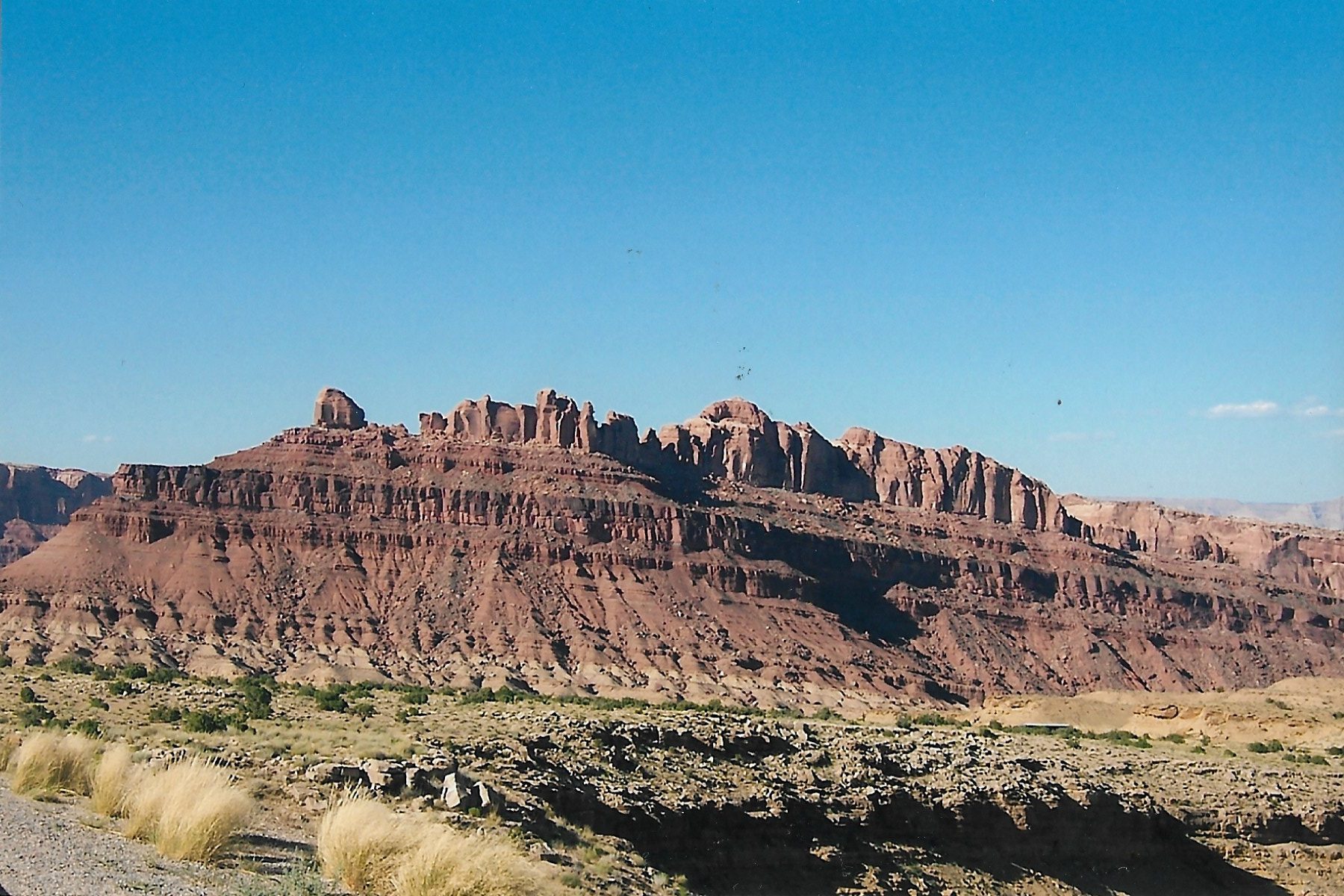
Back in 2005, the Vintage family went on a multi-week roadtrip to explore some of the natural wonders of the American Southwest. Our itinerary took us through states of Colorado, Arizona and Utah, and included visits to several National Parks.
While a lot has changed in the human world over the intervening 15 years, the beauty of the American Southwest remains the same.
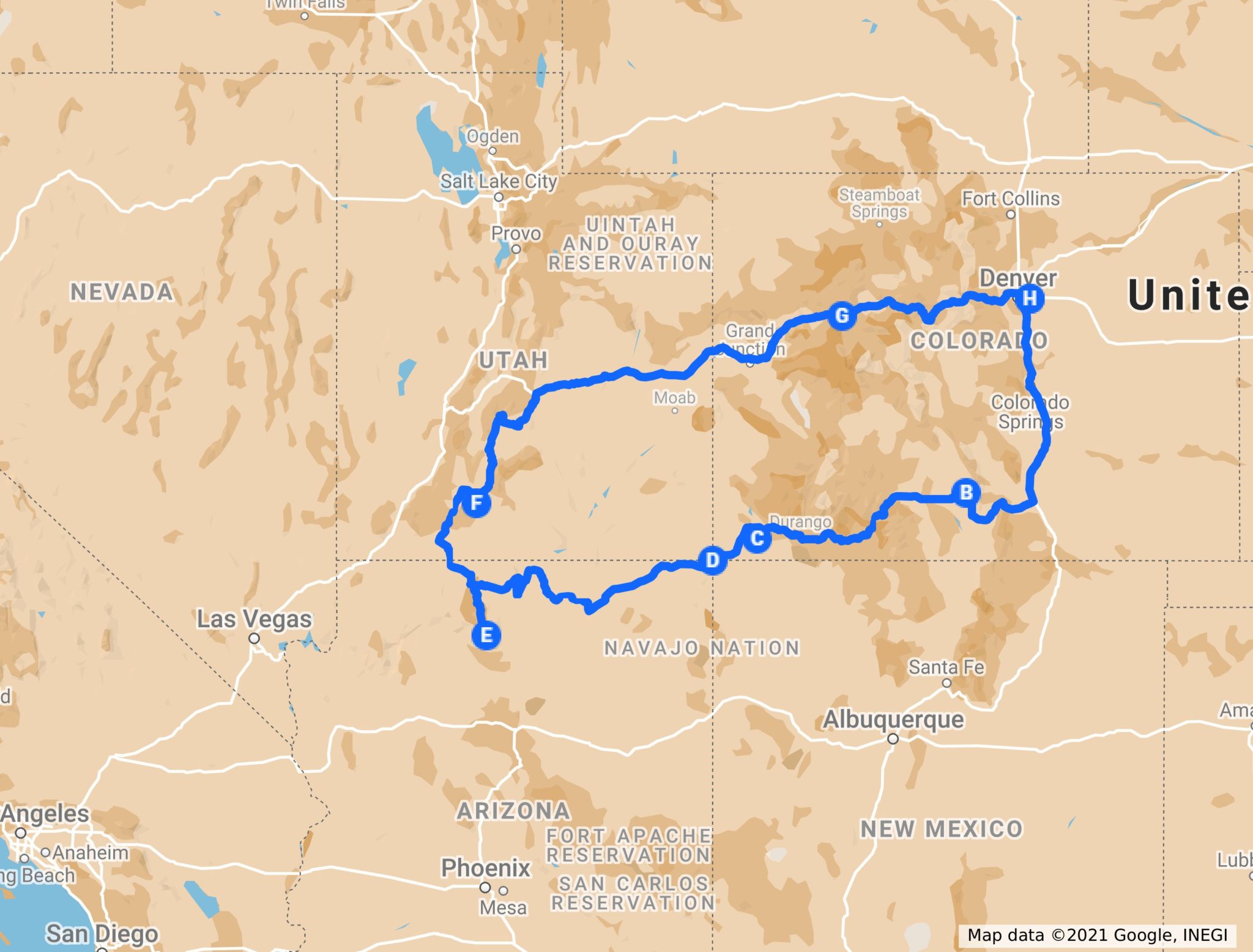
There is a region of the American Southwest that is sometimes referred to as “The Grand Circle”. This circle includes southwestern Colorado, northwestern New Mexico, large portions of Arizona and Utah, and a sliver of Nevada. Click on lthe link below to see a map of this circle.
Within this circle are some of the most beautiful and iconic areas of the American West. The Grand Canyon, the lakes Powell and Mead, the San Juan mountain range, reservations of the Navajo and Zuni, the towns of Santa Fe and Telluride, and so much more. It’s a land where Native American, Hispanic and American cultures once clashed, and now live side-by-side.
One could spend a lifetime exploring this region and still not see or do it all.
Check out this link to learn more about the Grand Circle: Home | The Grand Circle Association
The Trip
As I said, a lot has probably changed over the past 15 years as far as human activity goes, so I am not going to include places we ate or motels we stayed at because I have no way of knowing how those places are run now, or if they are even still in business.
B – Great Sand Dunes National Park
So on a very warm July day, we left our home (H on the map above) in the Denver Metro area and began our adventure by heading south. Our first stop was the Great Sand Dunes National Park.
The San Luis Valley, located in southcentral Colorado, is as flat a place you’ll find outside of Kansas. Over the millennia, winds blowing over the valley have pushed sand and dust to the feet of the Sangre de Cristo, located in southern Colorado. Over time, these grains of sand have piled up to form the tallest sand dunes in North America. This dune field is known today as The Great Sand Dunes National Park.
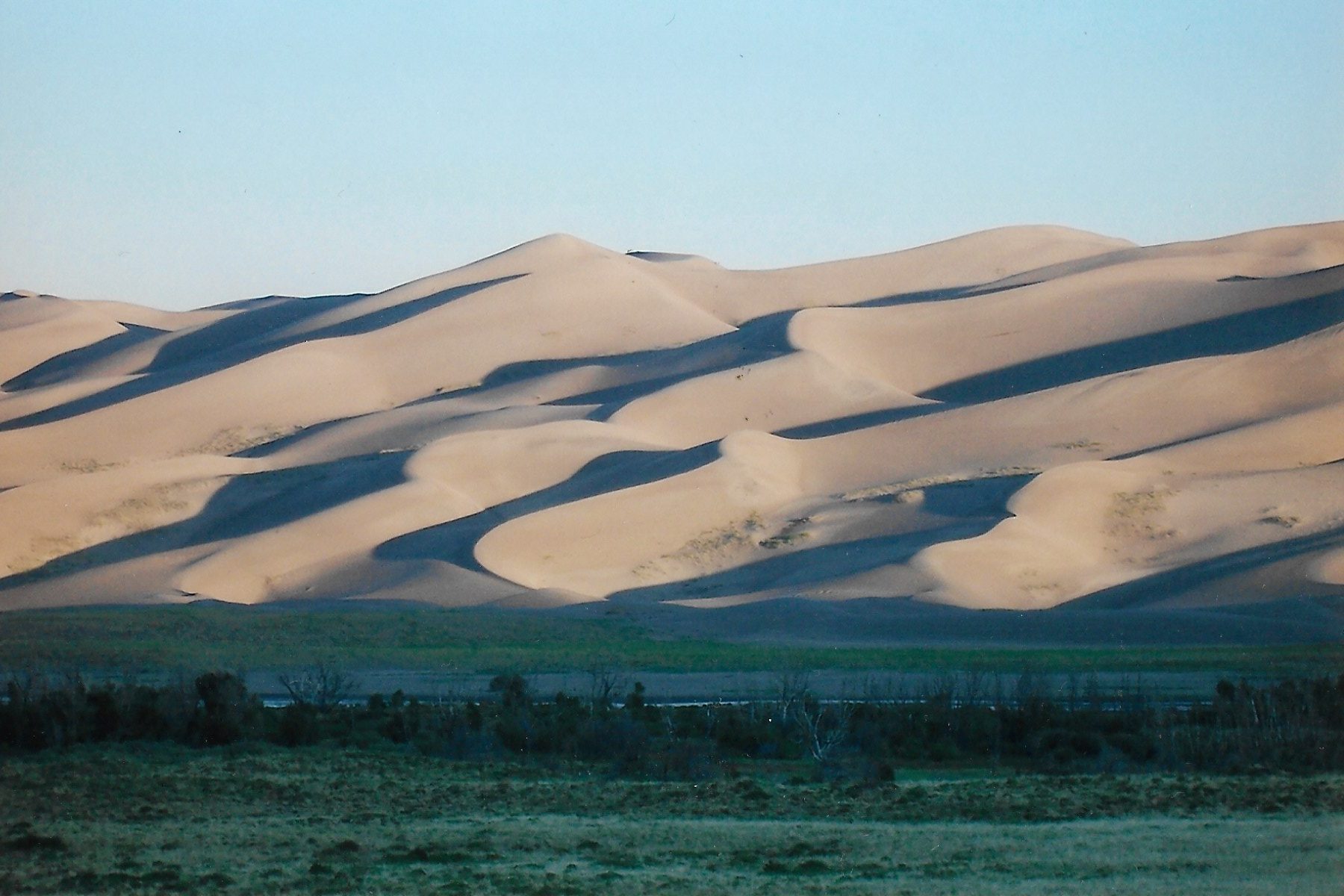
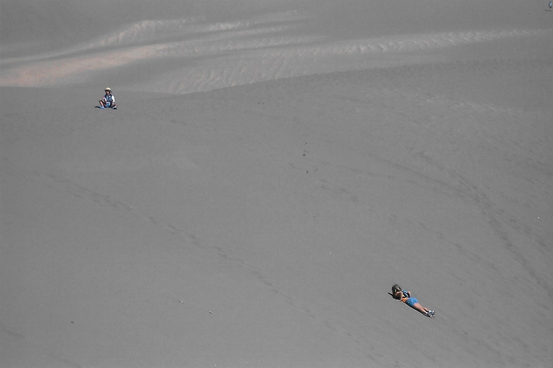
Obviously, these dunes are the showcase of the park. You can park near the foot of the dunes and walk right in and explore the dunes to your hearts content. A word of caution: I recommend starting early, because in summer those dunes get hot! Use lots of sunscreen, wear a hat and bring water. Lots and lots of water because you’ll need it.
When you’ve finished exploring the dunes, you can cool off by wallowing in Medano Creek, a tiny stream that flows at the foot of the dunes.
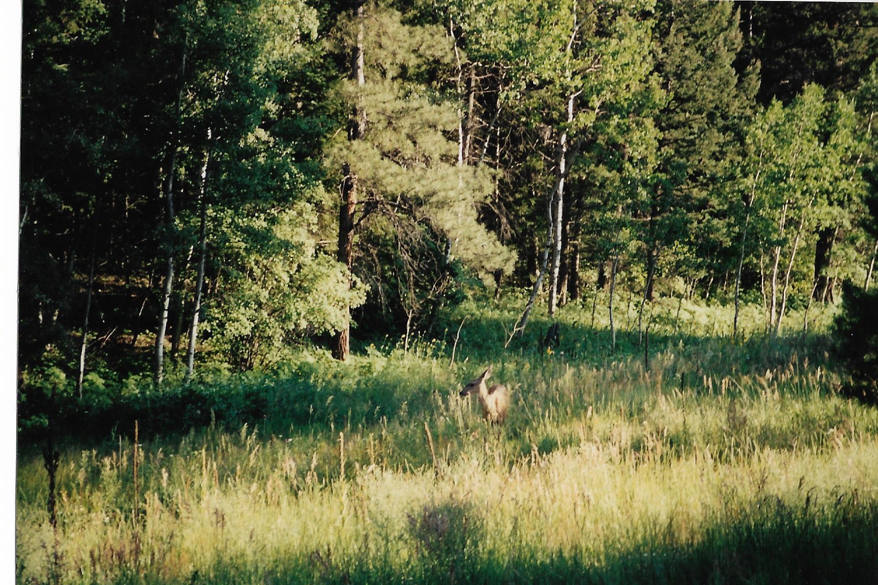
But there is more to the park than just the dunes. There are several hiking trails that wander off into the Sangre de Cristo mountains. We explored the Montville Nature trail, where we spotted the deer seen in the picture below. One of the longer trails will take you over Mosca Pass. There is even a trail that leads to alpine lakes called Sand Creek Lakes.
Amenities: we camped in the Pinon Flat campground. Beautiful campground that is in easy walking distance to the creek and dunes. Potable water and flush toilets are available. NOTE: nowadays you need to make reservations if you are going to camp in the campground. You can reserve online 6 months out online at: Pinon Flats Campground, Great Sand Dunes National Park & Preserve – Recreation.gov
There are a couple of small motels outside of the park, but I cannot attest to their quality. As far as food goes, you need to pack it in with you. The town of Alamosa is about a 45 minute drive away, and does offer multiple places for lodging and eating.
After a few days at the dunes, we broke camp and then made our way deeper into the American Southwest. Out next stop: Mesa Verde National Park.
C – Mesa Verde National Park
I don’t know if this little factoid is still true today, but during our visit one of the park Rangers informed us that Mesa Verde receives far more tourists from overseas than it does from Americans, especially from Germany and Japan. Which is damn shame, because Mesa Verde National Park is a fascinating place.
Quick history lesson: the ruins at Mesa Verde were built over several centuries by a people called the “Ancestral Puebloans” (Anasazi is no longer the official name for these ancient people. Anasazi means “ancient enemy” in the Navajo language). Sometime around 1300 A.D. the Ancestral Puebloans abandoned their homes for reasons not entirely known. It is now believed that they moved and settled further east and the Pueblo Indians are their descendants.
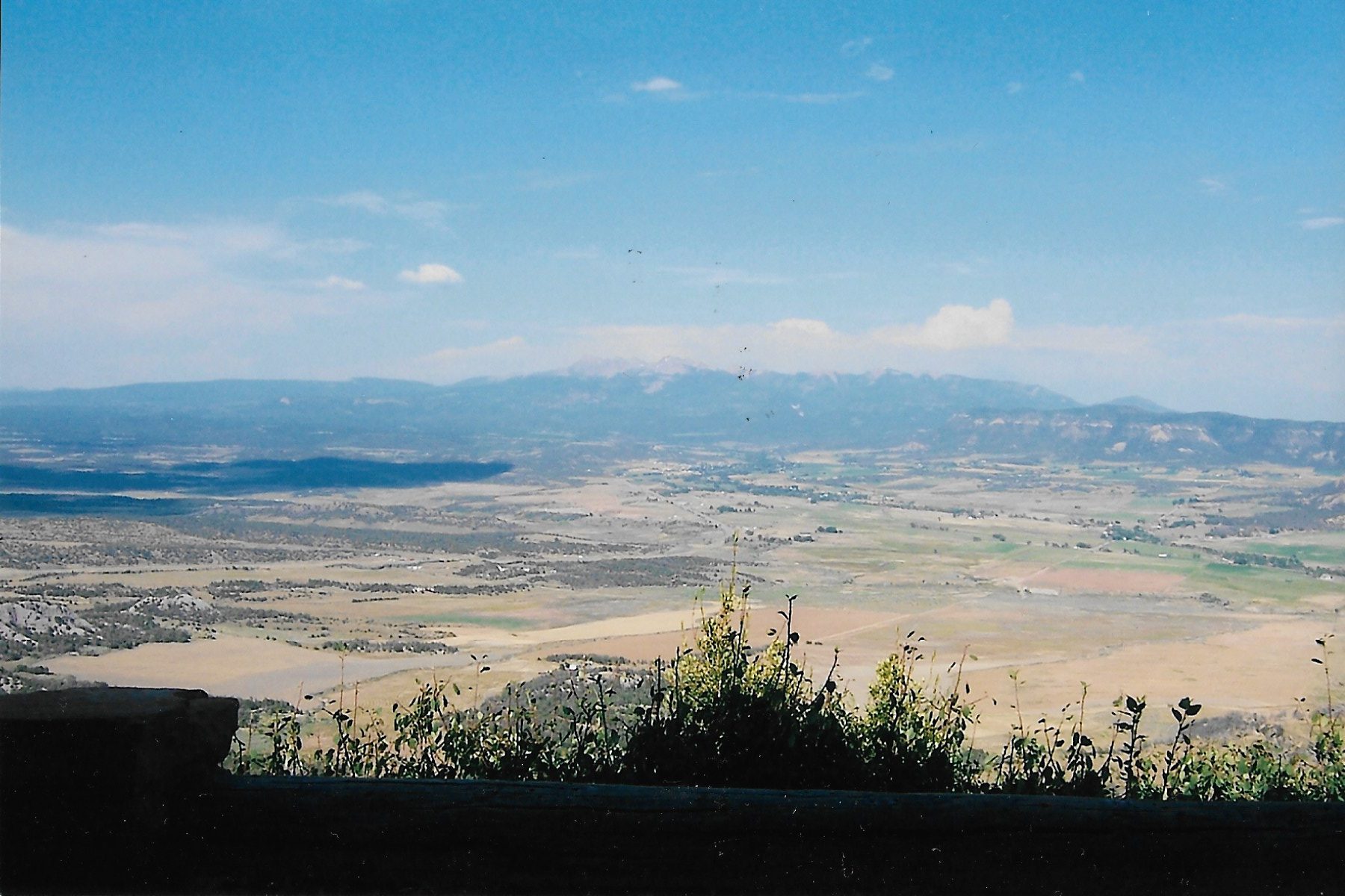
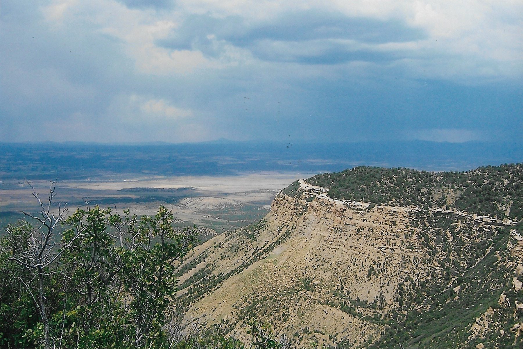
Mesa Verde is located in southwestern Colorado along Colorado Highway 160, near the Four Corners area. The entrance to the park is smack dab between the towns of Cortez and Mancos. The drive up to the park itself is breathtaking, as you can see in the photo below.
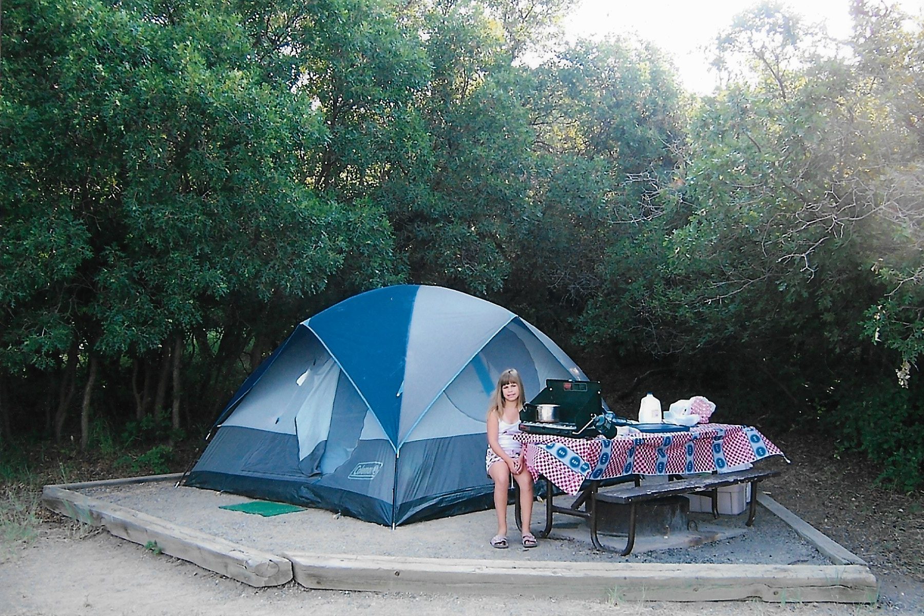
We camped in the park at Morefield campground. We were lucky enough to find a wonderful site shaded by Gambel oak. Morefield campground is the only campground on the mesa, but it has a lot of amenities: a store that provides ice and firewood, flushing toilets, potable water and laundry facilities. While we didn’t need to make reservations, nowadays a reservation is required.
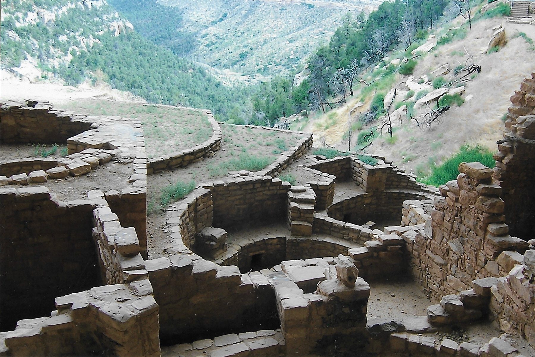
There is no way a blog post can ever do justice to all the things to see and do in Mesa Verde National Park. So, let me just show you a few high points of our visit there.
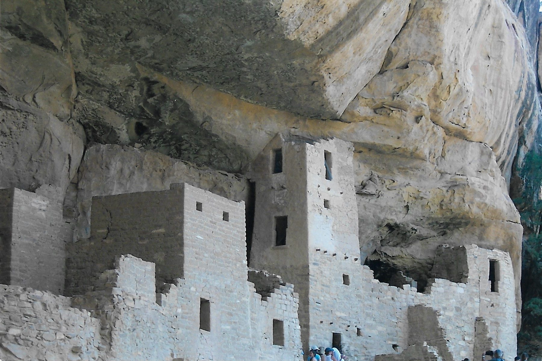
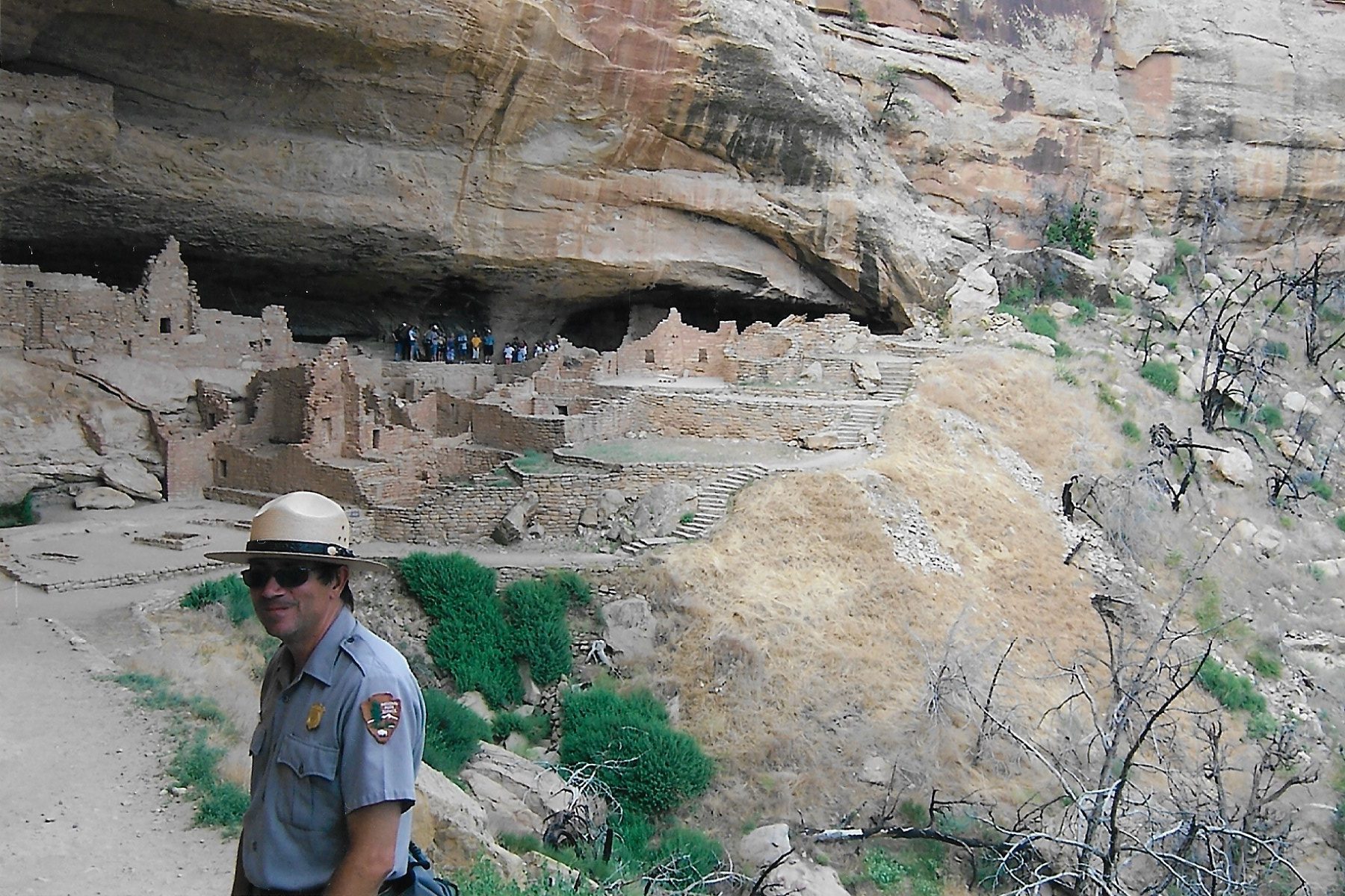
Cliff Palace and Spruce Tree house are two of the “must see” sites. Cliff Palace (seen below) is the largest ruin in the park.
The more popular ruins at Mesa Verde can become quite congested with fellow tourists, and wait times to see the sites is pretty much to be expected. To get away from the all the crowds, I suggest taking a drive along Wetherill Mesa Road…
…until you reach the Long House ruins. Long House is Ranger guided-only, which means you can’t just show up and wander around. According to the National Park Service website (Mesa Verde National Park (U.S. National Park Service) (nps.gov) the tour costs $8. But it is well worth it, because you can get much closer to the ruins.
I also recommend making a stop at the Chapin Mesa Archeological Museum, where you can learn all about the people who built these ruins as well as other artifacts from the park. We found the museum to be quite informative.
Amenities: if you want to camp at Mesa Verde, you can make your reservations at: Morefield Campground | Mesa Verde National Park CO | VisitMesaVerde.com.
If you don’t like camping, there is a motel in the park called Far View Lodge (reservations required). I have heard good things about it, but have never stayed there.
The towns of Mancos and Cortez are about an hour drive from the top of the mesa, and both towns have numerous restaurants and motels. Durango is further away, but is a good sized college town with lots of attractions and amenities.
After spending several days at Mesa Verde, it was time for us to push further into the desert. But first, a stop at Four Corners.
D – Four Corners
To be honest, there isn’t really a whole lot to say about Four Corners. It’s the location where the arbitrary boundary lines of four Western states meet (Utah, Colorado, New Mexico and Arizona), allowing you to say you’ve stood in four states at the same time. Whee? Four Corners ranks right up there with the world’s largest ball of yarn or the biggest prairie dog town.
So, of course, we HAD to stop there. I’d been there as a kid, so it was necessary for me to take my own children there. Let me lay out the tableau: Four Corners is a concrete pad with a giant circular copper medallion laying where the state lines are. It’s hot as hell, there is no shade and there’s a line of people waiting for their turn to take a picture. It’s on Navajo land, and when we visited all those years ago, it was $10 per person to get in. I have no idea what the price is now.
I’m glad we visited it, because now I never have to go back.
Next: The Great Southwest Desert Roadtrip Part 2 – Arizona and Utah